Springwood night lights from space
Night Light of Springwood (New South Wales) from space (Australia) Src. Average luminocity for 10x10km area is 7.4872% and for 50x50km: 9.3879%.
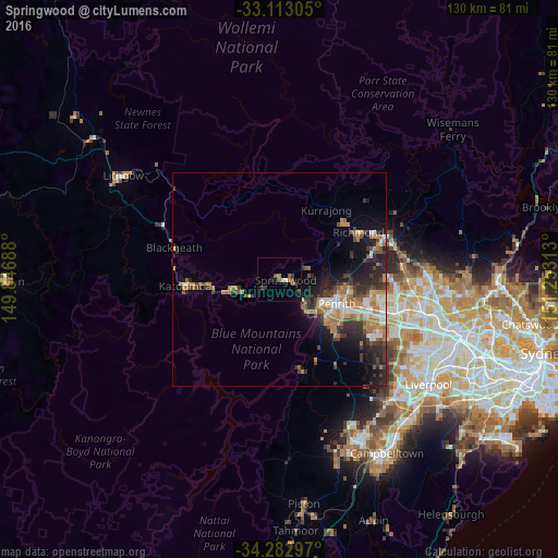
Analysis of Springwood night lights 2016
Square area 10x10 km:
 0.55%
0.55%90-99
0.18%80-89
0.73%70-79
0%60-69
2.2%50-59
0.73%40-49
2.75%30-39
3.11%20-29
0.73%10-19
0.37%0-9
88.64%Square area 50x50 km:
1.09%90-99
1.14%80-89
0.54%70-79
1.44%60-69
2.41%50-59
0.93%40-49
1.6%30-39
2.43%20-29
2.89%10-19
4.92%0-9
80.6%Clear (daylight) street map image can be seen on geolist.org.
Map coordinates:
33° 6' 47" South, 149° 50' 48.8" East
33° 42' 0" South, 150° 33' 0" East
34° 16' 58.7" South, 151° 15' 11.3" East
Some cities around Springwood sort by population:
• Glenmore Park
14.9 km =9.3 mi,  132°
132°
• Cranebrook
14.8 km =9.2 mi,  92°
92°
• Penrith
14.9 km =9.3 mi,  111°
111°
• South Penrith
15.7 km =9.8 mi,  121°
121°
• Emu Plains
12.1 km =7.5 mi, 117°
• Blaxland
7.2 km =4.5 mi,  140°
140°
• Winmalee
6.2 km =3.9 mi,  67°
67°
• Jamisontown
14 km =8.7 mi, 122°
2148582 (p: 8,358)
Sources (retrieved 2019-11-25):
» Earth at Night: Flat Maps 2012, 2016