Glen Iris night lights from space
Night Light of Glen Iris (Victoria) from space (Australia) Src. Average luminocity for 10x10km area is 92.1429% and for 50x50km: 54.4286%.
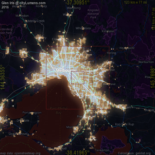
Analysis of Glen Iris night lights 2016
Square area 10x10 km:
 34.42%
90-99
31.01%80-89
20.13%70-79
13.96%60-69
0.49%50-59
0%40-49
0%30-39
0%20-29
0%10-19
0%0-9
0%Square area 50x50 km:
14.56%90-99
13.45%80-89
6.84%70-79
9.3%60-69
8.44%50-59
5.83%40-49
3.93%30-39
3.56%20-29
5.17%10-19
6.58%0-9
22.34%Clear (daylight) street map image can be seen on geolist.org.
Map coordinates:
37° 18' 34.2" South, 144° 21' 48.8" East
37° 52' 0" South, 145° 4' 0" East
38° 25' 10.7" South, 145° 46' 11.3" East
Some cities around Glen Iris sort by population:
• Camberwell
2.7 km =1.7 mi,  5°
5°
• Malvern East
2.3 km =1.4 mi,  249°
249°
• Carnegie
3.2 km =2 mi,  198°
198°
• Malvern
3.4 km =2.1 mi,  277°
277°
• Murrumbeena
3.7 km =2.3 mi,  180°
180°
• Chadstone
3.4 km =2.1 mi,  132°
132°
• Ashburton
1.5 km =0.9 mi,  90°
90°
• Ashwood
3.4 km =2.1 mi, 89°
2165290 (p: 24,838)
Sources (retrieved 2019-11-25):
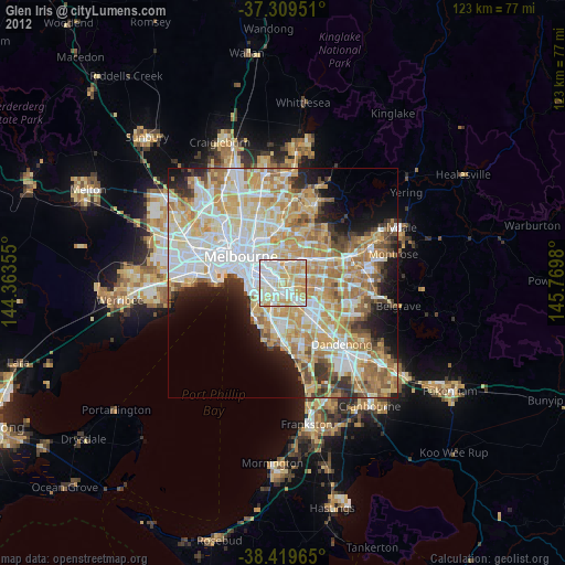
» Earth at Night: Flat Maps 2012, 2016