Collie night lights from space
Night Light of Collie (Western Australia) from space (Australia) Src. Average luminocity for 10x10km area is 5.9913% and for 50x50km: 1.146%.
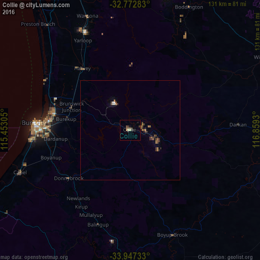
Analysis of Collie night lights 2016
Square area 10x10 km:
 0%
0%90-99
0.17%80-89
1.22%70-79
0%60-69
0.7%50-59
2.45%40-49
0.35%30-39
2.8%20-29
1.05%10-19
1.57%0-9
89.69%Square area 50x50 km:
0.07%90-99
0.05%80-89
0.05%70-79
0.02%60-69
0.43%50-59
0.21%40-49
0.22%30-39
0.48%20-29
0.16%10-19
0.21%0-9
98.1%Clear (daylight) street map image can be seen on geolist.org.
Map coordinates:
32° 46' 22.2" South, 115° 27' 11" East
33° 21' 43.4" South, 116° 9' 22.2" East
33° 56' 50.4" South, 116° 51' 33.5" East
Some cities around Collie sort by population:
• Bunbury
48 km =29.8 mi,  274°
274°
• Busselton
81.8 km =50.8 mi,  246°
246°
• Australind
42 km =26.1 mi,  282°
282°
• Dalyellup
50.5 km =31.4 mi,  264°
264°
• Eaton
42.2 km =26.2 mi, 276°
• West Busselton
84 km =52.2 mi, 246°
• South Bunbury
48.6 km =30.2 mi, 271°
• Carey Park
47.1 km =29.3 mi, 271°
2074113 (p: 7,396)
Sources (retrieved 2019-11-25):
» Earth at Night: Flat Maps 2012, 2016