Bunbury night lights from space
Night Light of Bunbury (Western Australia) from space (Australia) Src. Average luminocity for 10x10km area is 36.7255% and for 50x50km: 3.8993%.
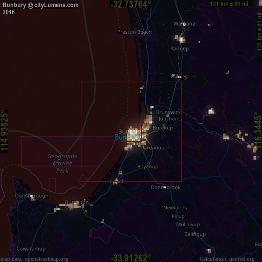
Analysis of Bunbury night lights 2016
Square area 10x10 km:
 3.67%
3.67%90-99
5.77%80-89
1.75%70-79
3.32%60-69
16.96%50-59
8.92%40-49
1.57%30-39
2.1%20-29
5.59%10-19
27.45%0-9
22.9%Square area 50x50 km:
0.19%90-99
0.36%80-89
0.14%70-79
0.27%60-69
1.5%50-59
1.03%40-49
0.51%30-39
0.98%20-29
0.65%10-19
2.94%0-9
91.43%Clear (daylight) street map image can be seen on geolist.org.
Map coordinates:
32° 44' 15.5" South, 114° 56' 17.7" East
33° 19' 37.6" South, 115° 38' 28.9" East
33° 54' 45.4" South, 116° 20' 40.2" East
Some cities around Bunbury sort by population:
• Busselton
45.4 km =28.2 mi,  217°
217°
• Australind
8.7 km =5.4 mi,  52°
52°
• Dalyellup
9.4 km =5.8 mi,  195°
195°
• Eaton
6 km =3.7 mi,  78°
78°
• West Busselton
47.2 km =29.3 mi, 218°
• South Bunbury
2.5 km =1.6 mi, 196°
• Collie
48 km =29.8 mi,  94°
94°
• Carey Park
2.5 km =1.6 mi,  163°
163°
2075432 (p: 68,248)
Sources (retrieved 2019-11-25):
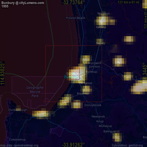
» NASA, Earths city lights 1995
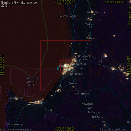
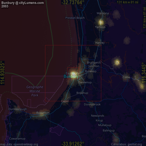
» NASA city lights 2003
» Earth at Night: Flat Maps 2012, 2016