Chapel Hill night lights from space
Night Light of Chapel Hill (Queensland) from space (Australia) Src. Average luminocity for 10x10km area is 62.0595% and for 50x50km: 44.8675%.
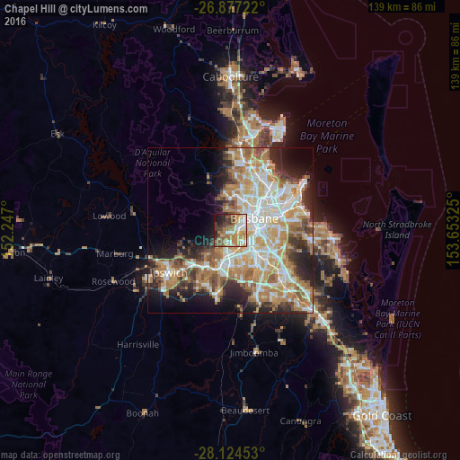
Analysis of Chapel Hill night lights 2016
Square area 10x10 km:
 7.94%
7.94%90-99
12.3%80-89
6.75%70-79
12.1%60-69
20.04%50-59
8.93%40-49
8.93%30-39
8.13%20-29
7.74%10-19
7.14%0-9
0%Square area 50x50 km:
9.06%90-99
9.73%80-89
5.62%70-79
6.46%60-69
11.73%50-59
3.96%40-49
4.69%30-39
4.24%20-29
7.48%10-19
8.59%0-9
28.44%Clear (daylight) street map image can be seen on geolist.org.
Map coordinates:
26° 52' 38" South, 152° 14' 49.2" East
27° 30' 9.5" South, 152° 57' 0.4" East
28° 7' 28.3" South, 153° 39' 11.7" East
Some cities around Chapel Hill sort by population:
• Indooroopilly
2.5 km =1.6 mi,  90°
90°
• Toowong
3.9 km =2.4 mi,  56°
56°
• Bardon
5.4 km =3.4 mi,  31°
31°
• Kenmore
1.2 km =0.7 mi,  243°
243°
• Taringa
3.1 km =1.9 mi, 64°
• Sinnamon Park
4.6 km =2.9 mi,  181°
181°
• Auchenflower
5.2 km =3.2 mi,  52°
52°
• Jindalee
3.7 km =2.3 mi,  198°
198°
6931019 (p: 9,866)
Sources (retrieved 2019-11-25):
» Earth at Night: Flat Maps 2012, 2016