Toowong night lights from space
Night Light of Toowong (Queensland) from space (Australia) Src. Average luminocity for 10x10km area is 80.2917% and for 50x50km: 45.6378%.
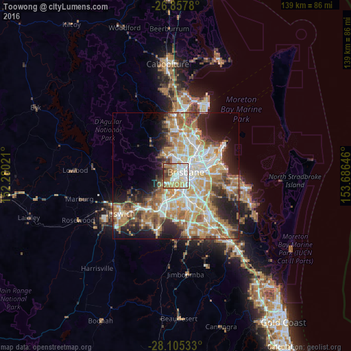
Analysis of Toowong night lights 2016
Square area 10x10 km:
 20.83%
90-99
23.21%80-89
12.3%70-79
10.32%60-69
18.25%50-59
6.15%40-49
4.96%30-39
2.78%20-29
1.19%10-19
0%0-9
0%Square area 50x50 km:
8.99%90-99
9.7%80-89
5.77%70-79
6.47%60-69
12.41%50-59
4.25%40-49
4.8%30-39
4.38%20-29
7.35%10-19
9.45%0-9
26.43%Clear (daylight) street map image can be seen on geolist.org.
Map coordinates:
26° 51' 28.1" South, 152° 16' 48.8" East
27° 28' 60" South, 152° 58' 60" East
28° 6' 19.2" South, 153° 41' 11.3" East
Some cities around Toowong sort by population:
• Indooroopilly
2.3 km =1.4 mi,  200°
200°
• West End
2.6 km =1.6 mi,  80°
80°
• Bardon
2.5 km =1.6 mi,  350°
350°
• South Brisbane
3.7 km =2.3 mi, 84°
• Paddington
2.9 km =1.8 mi,  23°
23°
• Taringa
0.9 km =0.6 mi,  209°
209°
• Auchenflower
1.3 km =0.8 mi,  41°
41°
• Highgate Hill
3.6 km =2.2 mi,  100°
100°
2146270 (p: 10,780)
Sources (retrieved 2019-11-25):
» Earth at Night: Flat Maps 2012, 2016