Campbell night lights from space
Night Light of Campbell (ACT) from space (Australia) Src. Average luminocity for 10x10km area is 70.1282% and for 50x50km: 16.1417%.
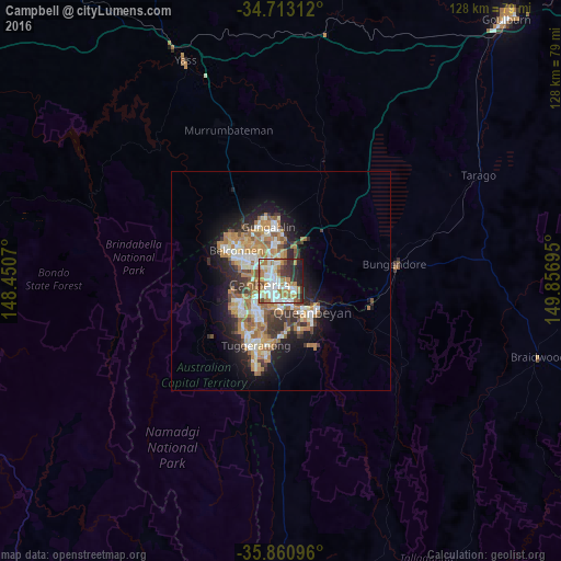
Analysis of Campbell night lights 2016
Square area 10x10 km:
 18.32%
90-99
21.06%80-89
3.11%70-79
9.52%60-69
17.03%50-59
4.76%40-49
4.21%30-39
8.24%20-29
10.44%10-19
3.3%0-9
0%Square area 50x50 km:
2.48%90-99
3.12%80-89
1.55%70-79
2.46%60-69
3.95%50-59
1.85%40-49
1.39%30-39
2.65%20-29
3.46%10-19
7.19%0-9
69.91%Clear (daylight) street map image can be seen on geolist.org.
Map coordinates:
34° 42' 47.2" South, 148° 27' 2.5" East
35° 17' 20.7" South, 149° 9' 13.8" East
35° 51' 39.5" South, 149° 51' 25" East
Some cities around Campbell sort by population:
• Canberra
2.4 km =1.5 mi,  284°
284°
• Braddon
2.6 km =1.6 mi,  321°
321°
• Narrabundah
5.2 km =3.2 mi,  184°
184°
• Watson
5.7 km =3.5 mi,  358°
358°
• O'Connor
5.2 km =3.2 mi,  314°
314°
• City
2.4 km =1.5 mi,  291°
291°
• Lyneham
5.9 km =3.7 mi,  339°
339°
• Ainslie
3.1 km =1.9 mi, 342°
2172618 (p: 5,050)
Sources (retrieved 2019-11-25):
» Earth at Night: Flat Maps 2012, 2016