Buderim night lights from space
Night Light of Buderim (Queensland) from space (Australia) Src. Average luminocity for 10x10km area is 51.233% and for 50x50km: 8.8169%.
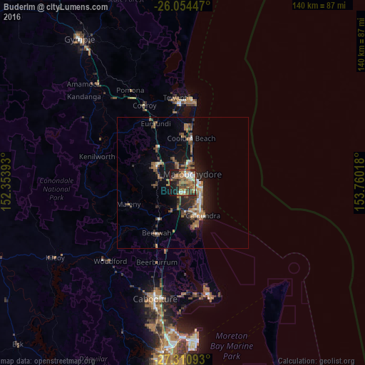
Analysis of Buderim night lights 2016
Square area 10x10 km:
 6.44%
6.44%90-99
6.06%80-89
3.03%70-79
4.36%60-69
26.89%50-59
6.63%40-49
8.9%30-39
9.66%20-29
8.71%10-19
18.56%0-9
0.76%Square area 50x50 km:
0.65%90-99
0.9%80-89
0.53%70-79
0.52%60-69
3.53%50-59
1.19%40-49
1.57%30-39
1.37%20-29
2.28%10-19
6.55%0-9
80.9%Clear (daylight) street map image can be seen on geolist.org.
Map coordinates:
26° 3' 16.1" South, 152° 21' 14.1" East
26° 41' 3.9" South, 153° 3' 25.4" East
27° 18' 39.3" South, 153° 45' 36.6" East
Some cities around Buderim sort by population:
• Maroochydore
5 km =3.1 mi,  57°
57°
• Mountain Creek
4.8 km =3 mi,  114°
114°
• Sippy Downs
3.7 km =2.3 mi,  183°
183°
• Mooloolaba
6.2 km =3.9 mi,  87°
87°
• Bli Bli
7.7 km =4.8 mi,  344°
344°
• Currimundi
11.4 km =7.1 mi,  145°
145°
• Wurtulla
10.7 km =6.6 mi,  138°
138°
• Palmwoods
9.5 km =5.9 mi,  269°
269°
2173605 (p: 28,774)
Sources (retrieved 2019-11-25):
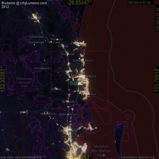
» Earth at Night: Flat Maps 2012, 2016