Bray Park night lights from space
Night Light of Bray Park (Queensland) from space (Australia) Src. Average luminocity for 10x10km area is 60.1061% and for 50x50km: 28.6379%.
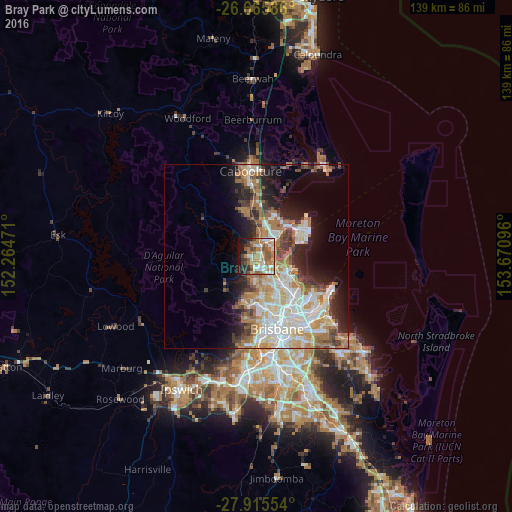
Analysis of Bray Park night lights 2016
Square area 10x10 km:
 11.74%
90-99
9.28%80-89
6.25%70-79
5.68%60-69
23.67%50-59
11.17%40-49
5.49%30-39
6.82%20-29
7.01%10-19
12.31%0-9
0.57%Square area 50x50 km:
5.64%90-99
6.22%80-89
3.64%70-79
3.05%60-69
7.43%50-59
2.35%40-49
3.1%30-39
3.19%20-29
4.84%10-19
8.58%0-9
51.96%Clear (daylight) street map image can be seen on geolist.org.
Map coordinates:
26° 39' 57.1" South, 152° 15' 53" East
27° 17' 32.9" South, 152° 58' 4.2" East
27° 54' 55.9" South, 153° 40' 15.5" East
Some cities around Bray Park sort by population:
• Kallangur
5.1 km =3.2 mi,  28°
28°
• Warner
2.8 km =1.7 mi,  219°
219°
• Murrumba Downs
5.1 km =3.2 mi,  56°
56°
• Strathpine
2.5 km =1.6 mi,  120°
120°
• Petrie
3.3 km =2.1 mi, 28°
• Eatons Hill
5.3 km =3.3 mi,  188°
188°
• Bald Hills
5.1 km =3.2 mi,  128°
128°
• Lawnton
1.8 km =1.1 mi, 56°
8349226 (p: 10,099)
Sources (retrieved 2019-11-25):
» Earth at Night: Flat Maps 2012, 2016