Bonner night lights from space
Night Light of Bonner (ACT) from space (Australia) Src. Average luminocity for 10x10km area is 36.1189% and for 50x50km: 12.9333%.
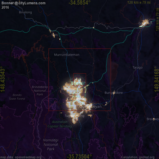
Analysis of Bonner night lights 2016
Square area 10x10 km:
 3.67%
3.67%90-99
7.52%80-89
4.9%70-79
6.29%60-69
8.92%50-59
5.07%40-49
0%30-39
2.8%20-29
7.87%10-19
26.4%0-9
26.57%Square area 50x50 km:
2.15%90-99
2.62%80-89
1.22%70-79
1.83%60-69
3.28%50-59
1.54%40-49
1.13%30-39
2.15%20-29
2.54%10-19
4.68%0-9
76.87%Clear (daylight) street map image can be seen on geolist.org.
Map coordinates:
34° 35' 7.4" South, 148° 26' 7.5" East
35° 9' 44.1" South, 149° 8' 18.8" East
35° 44' 6.1" South, 149° 50' 30" East
Some cities around Bonner sort by population:
• Ngunnawal
2.7 km =1.7 mi,  244°
244°
• Harrison
4.4 km =2.7 mi,  158°
158°
• Nicholls
4.7 km =2.9 mi,  233°
233°
• Franklin
4.2 km =2.6 mi,  174°
174°
• Gungahlin
2.7 km =1.7 mi,  184°
184°
• Casey
4 km =2.5 mi,  262°
262°
• Amaroo
1.3 km =0.8 mi, 229°
• Palmerston
4 km =2.5 mi,  205°
205°
9973375 (p: 6,677)
Sources (retrieved 2019-11-25):
» Earth at Night: Flat Maps 2012, 2016