Beaumaris night lights from space
Night Light of Beaumaris (Victoria) from space (Australia) Src. Average luminocity for 10x10km area is 44.4237% and for 50x50km: 44.9491%.
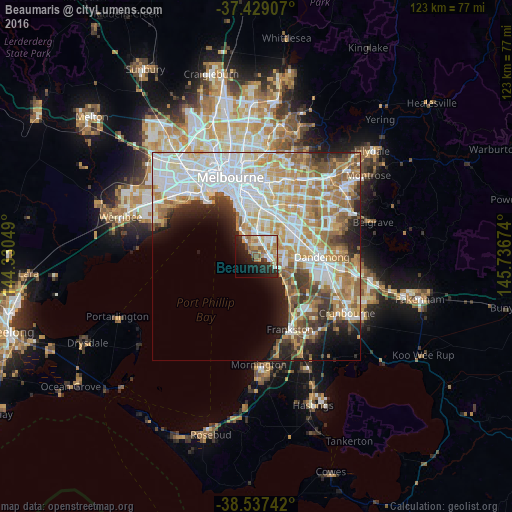
Analysis of Beaumaris night lights 2016
Square area 10x10 km:
 7.47%
7.47%90-99
9.9%80-89
3.57%70-79
7.63%60-69
8.44%50-59
7.31%40-49
2.76%30-39
2.11%20-29
15.26%10-19
19.32%0-9
16.23%Square area 50x50 km:
12.69%90-99
10.75%80-89
4.8%70-79
7.23%60-69
6.88%50-59
5.31%40-49
3.29%30-39
3.31%20-29
5.07%10-19
6.18%0-9
34.47%Clear (daylight) street map image can be seen on geolist.org.
Map coordinates:
37° 25' 44.7" South, 144° 19' 49.8" East
37° 59' 7.2" South, 145° 2' 1" East
38° 32' 14.7" South, 145° 44' 12.3" East
Some cities around Beaumaris sort by population:
• Cheltenham
2.2 km =1.4 mi,  35°
35°
• Mentone
2.9 km =1.8 mi,  85°
85°
• Hampton
4.9 km =3 mi,  323°
323°
• Parkdale
4.2 km =2.6 mi,  99°
99°
• Highett
4.2 km =2.6 mi,  20°
20°
• Sandringham
4.2 km =2.6 mi,  332°
332°
• Mordialloc
4.7 km =2.9 mi,  110°
110°
• Black Rock
2 km =1.2 mi,  310°
310°
2176487 (p: 12,959)
Sources (retrieved 2019-11-25):
» Earth at Night: Flat Maps 2012, 2016