Bargara night lights from space
Night Light of Bargara (Queensland) from space (Australia) Src. Average luminocity for 10x10km area is 5.9508% and for 50x50km: 2.5096%.
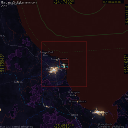
Analysis of Bargara night lights 2016
Square area 10x10 km:
 0%
0%90-99
0%80-89
0.76%70-79
0.76%60-69
0.76%50-59
2.27%40-49
2.08%30-39
0.76%20-29
0.95%10-19
0.76%0-9
90.91%Square area 50x50 km:
0.25%90-99
0.15%80-89
0.19%70-79
0.48%60-69
0.52%50-59
0.35%40-49
0.57%30-39
0.35%20-29
0.28%10-19
2.33%0-9
94.53%Clear (daylight) street map image can be seen on geolist.org.
Map coordinates:
24° 10' 29.7" South, 151° 45' 34" East
24° 48' 53.1" South, 152° 27' 45.3" East
25° 27' 4.7" South, 153° 9' 56.5" East
Some cities around Bargara sort by population:
• Bundaberg
12.9 km =8 mi,  243°
243°
• Hervey Bay
61 km =37.9 mi,  149°
149°
• Maryborough
84.3 km =52.4 mi,  163°
163°
• Urangan
69.3 km =43.1 mi,  139°
139°
• Torquay
67 km =41.6 mi, 141°
• Urraween
64.5 km =40.1 mi, 145°
• Point Vernon
60.8 km =37.8 mi, 144°
• Bundaberg North
12.3 km =7.6 mi,  251°
251°
2176868 (p: 8,170)
Sources (retrieved 2019-11-25):
» Earth at Night: Flat Maps 2012, 2016