Bundaberg North night lights from space
Night Light of Bundaberg North (Queensland) from space (Australia) Src. Average luminocity for 10x10km area is 35.1515% and for 50x50km: 2.5179%.
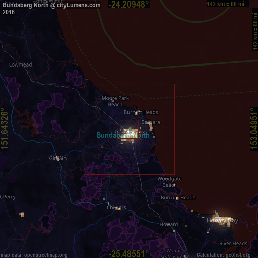
Analysis of Bundaberg North night lights 2016
Square area 10x10 km:
 5.68%
5.68%90-99
3.41%80-89
2.27%70-79
9.85%60-69
8.52%50-59
3.41%40-49
6.63%30-39
3.98%20-29
1.89%10-19
24.62%0-9
29.73%Square area 50x50 km:
0.25%90-99
0.15%80-89
0.19%70-79
0.48%60-69
0.52%50-59
0.35%40-49
0.57%30-39
0.35%20-29
0.28%10-19
2.36%0-9
94.5%Clear (daylight) street map image can be seen on geolist.org.
Map coordinates:
24° 12' 34.1" South, 151° 38' 35.7" East
24° 50' 56.9" South, 152° 20' 47" East
25° 29' 7.8" South, 153° 2' 58.2" East
Some cities around Bundaberg North sort by population:
• Hervey Bay
64.7 km =40.2 mi,  138°
138°
• Maryborough
84.9 km =52.8 mi,  154°
154°
• Urangan
74.8 km =46.5 mi,  131°
131°
• Bargara
12.3 km =7.6 mi,  71°
71°
• Torquay
72.3 km =44.9 mi, 132°
• Urraween
69 km =42.9 mi, 135°
• Point Vernon
65.6 km =40.8 mi, 133°
• Tinana
84.5 km =52.5 mi,  157°
157°
11704264 (p: 5,447)
Sources (retrieved 2019-11-25):
» Earth at Night: Flat Maps 2012, 2016