Bundaberg night lights from space
Night Light of Bundaberg (Queensland) from space (Australia) Src. Average luminocity for 10x10km area is 41.75% and for 50x50km: 2.5184%.
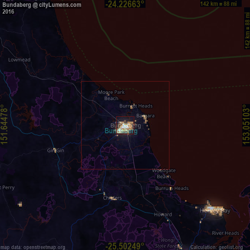
Analysis of Bundaberg night lights 2016
Square area 10x10 km:
 6.06%
6.06%90-99
3.79%80-89
3.79%70-79
10.98%60-69
9.85%50-59
5.11%40-49
8.71%30-39
4.73%20-29
3.22%10-19
32.39%0-9
11.36%Square area 50x50 km:
0.25%90-99
0.15%80-89
0.19%70-79
0.48%60-69
0.52%50-59
0.35%40-49
0.57%30-39
0.35%20-29
0.28%10-19
2.36%0-9
94.5%Clear (daylight) street map image can be seen on geolist.org.
Map coordinates:
24° 13' 35.9" South, 151° 38' 41.2" East
24° 51' 58.4" South, 152° 20' 52.4" East
25° 30' 9" South, 153° 3' 3.7" East
Some cities around Bundaberg sort by population:
• Hervey Bay
63.2 km =39.3 mi,  137°
137°
• Maryborough
83.2 km =51.7 mi,  154°
154°
• Urangan
73.4 km =45.6 mi,  130°
130°
• Bargara
12.9 km =8 mi,  63°
63°
• Torquay
70.9 km =44.1 mi, 131°
• Urraween
67.5 km =41.9 mi, 134°
• Point Vernon
64.2 km =39.9 mi, 132°
• Tinana
82.7 km =51.4 mi,  157°
157°
2173323 (p: 70,826)
Sources (retrieved 2019-11-25):
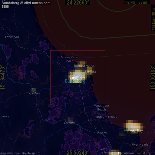
» NASA, Earths city lights 1995
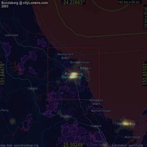
» NASA city lights 2003
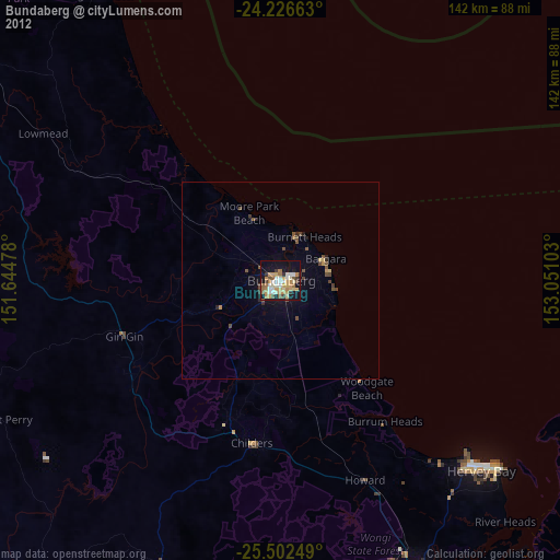
» Earth at Night: Flat Maps 2012, 2016