Aspendale Gardens night lights from space
Night Light of Aspendale Gardens (Victoria) from space (Australia) Src. Average luminocity for 10x10km area is 56.1136% and for 50x50km: 38.4728%.
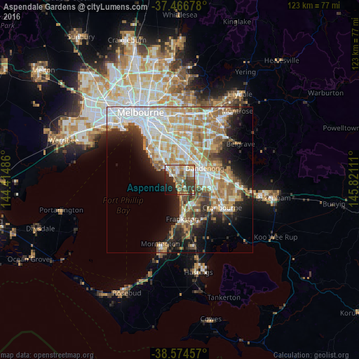
Analysis of Aspendale Gardens night lights 2016
Square area 10x10 km:
 7.14%
7.14%90-99
11.69%80-89
5.52%70-79
10.71%60-69
11.69%50-59
11.69%40-49
6.98%30-39
12.18%20-29
9.9%10-19
9.74%0-9
2.76%Square area 50x50 km:
9.38%90-99
8.31%80-89
3.82%70-79
6.63%60-69
6.42%50-59
5.16%40-49
3.25%30-39
3.61%20-29
5.63%10-19
9.54%0-9
38.25%Clear (daylight) street map image can be seen on geolist.org.
Map coordinates:
37° 28' 0.4" South, 144° 24' 53.5" East
38° 1' 22" South, 145° 7' 4.7" East
38° 34' 28.5" South, 145° 49' 16" East
Some cities around Aspendale Gardens sort by population:
• Parkdale
4.7 km =2.9 mi,  316°
316°
• Dingley Village
4.7 km =2.9 mi,  17°
17°
• Mordialloc
4 km =2.5 mi,  309°
309°
• Chelsea
3 km =1.9 mi,  182°
182°
• Patterson Lakes
5.6 km =3.5 mi,  156°
156°
• Bonbeach
4.7 km =2.9 mi,  174°
174°
• Edithvale
1.8 km =1.1 mi,  204°
204°
• Chelsea Heights
1.8 km =1.1 mi,  131°
131°
7932653 (p: 6,420)
Sources (retrieved 2019-11-25):
» Earth at Night: Flat Maps 2012, 2016