Adamstown night lights from space
Night Light of Adamstown (New South Wales) from space (Australia) Src. Average luminocity for 10x10km area is 70.3352% and for 50x50km: 15.0158%.
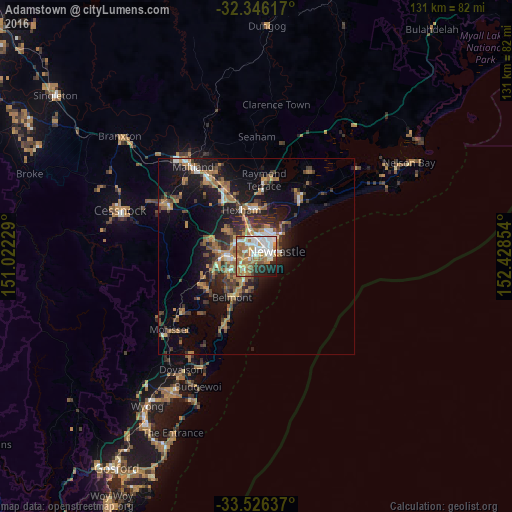
Analysis of Adamstown night lights 2016
Square area 10x10 km:
 17.4%
17.4%90-99
19.78%80-89
3.85%70-79
11.9%60-69
19.05%50-59
8.79%40-49
1.83%30-39
2.93%20-29
9.34%10-19
4.95%0-9
0.18%Square area 50x50 km:
1.47%90-99
1.76%80-89
0.55%70-79
2.43%60-69
4.29%50-59
2.11%40-49
2.04%30-39
3.35%20-29
3.78%10-19
10.36%0-9
67.85%Clear (daylight) street map image can be seen on geolist.org.
Map coordinates:
32° 20' 46.2" South, 151° 1' 20.2" East
32° 56' 17.7" South, 151° 43' 31.5" East
33° 31' 34.9" South, 152° 25' 42.7" East
Some cities around Adamstown sort by population:
• Newcastle
5.2 km =3.2 mi,  79°
79°
• Wallsend
7 km =4.3 mi,  305°
305°
• Charlestown
4.5 km =2.8 mi,  221°
221°
• Merewether
2 km =1.2 mi,  123°
123°
• New Lambton
1.9 km =1.2 mi,  304°
304°
• Mayfield
4.6 km =2.9 mi,  12°
12°
• Warners Bay
7.8 km =4.8 mi,  240°
240°
• Elermore Vale
5.2 km =3.2 mi, 298°
8348418 (p: 5,904)
Sources (retrieved 2019-11-25):
» Earth at Night: Flat Maps 2012, 2016