Graz night lights from space
Night Light of Graz (Styria) from space (Austria) Src. Average luminocity for 10x10km area is 65.0483% and for 50x50km: 6.6007%.
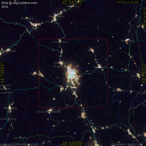
Analysis of Graz night lights 2016
Square area 10x10 km:
 13.21%
90-99
22.02%80-89
6.68%70-79
10.09%60-69
8.1%50-59
5.82%40-49
6.39%30-39
6.68%20-29
10.65%10-19
8.52%0-9
1.85%Square area 50x50 km:
0.81%90-99
1.22%80-89
0.54%70-79
0.83%60-69
0.83%50-59
1.04%40-49
0.97%30-39
1.07%20-29
1.89%10-19
3.84%0-9
86.97%Clear (daylight) street map image can be seen on geolist.org.
Map coordinates:
47° 32' 36.4" North, 14° 44' 48.8" East
47° 4' 0" North, 15° 27' 0" East
46° 35' 8.1" North, 16° 9' 11.3" East
Some cities around Graz sort by population:
• Jakomini
1.4 km =0.9 mi,  180°
180°
• Lend
3.1 km =1.9 mi,  304°
304°
• Gries
2 km =1.2 mi,  256°
256°
• Geidorf
2 km =1.2 mi,  346°
346°
• Sankt Leonhard
0.7 km =0.4 mi,  64°
64°
• Sankt Peter
2.2 km =1.4 mi,  145°
145°
• Waltendorf
1.3 km =0.8 mi,  90°
90°
• Ries
3.2 km =2 mi, 55°
2778067 (p: 222,326)
Sources (retrieved 2019-11-25):
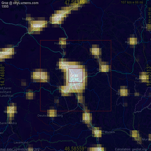
» NASA, Earths city lights 1995
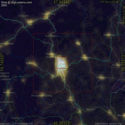
» NASA city lights 2003
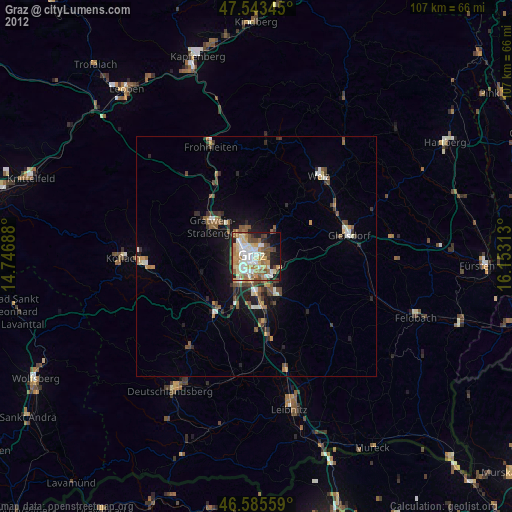
» Earth at Night: Flat Maps 2012, 2016