Telfs night lights from space
Night Light of Telfs (Tyrol) from space (Austria) Src. Average luminocity for 10x10km area is 8.0878% and for 50x50km: 2.8797%.
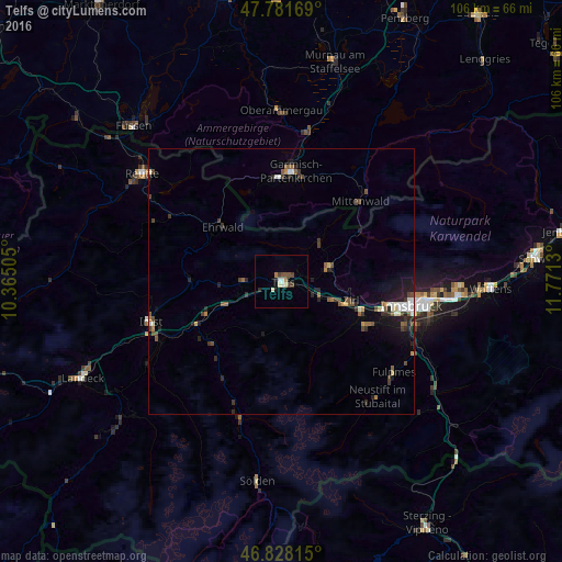
Analysis of Telfs night lights 2016
Square area 10x10 km:
 1.04%
1.04%90-99
1.93%80-89
0.6%70-79
0%60-69
1.19%50-59
1.04%40-49
2.38%30-39
0.74%20-29
0.6%10-19
1.19%0-9
89.29%Square area 50x50 km:
0.26%90-99
0.48%80-89
0.19%70-79
0.13%60-69
0.31%50-59
0.51%40-49
0.69%30-39
0.53%20-29
0.89%10-19
1.61%0-9
94.39%Clear (daylight) street map image can be seen on geolist.org.
Map coordinates:
47° 46' 54.1" North, 10° 21' 54.2" East
47° 18' 25.5" North, 11° 4' 5.4" East
46° 49' 41.3" North, 11° 46' 16.7" East
Some cities around Telfs sort by population:
• Innsbruck
25.1 km =15.6 mi,  101°
101°
• Hötting
23.1 km =14.4 mi, 100°
• Garmisch-Partenkirchen, DE
20.7 km =12.9 mi,  5°
5°
• Wilten
24.7 km =15.3 mi, 102°
• Zirl
13.4 km =8.3 mi,  105°
105°
• Mittenwald, DE
20.9 km =13 mi,  44°
44°
• Völs
21 km =13 mi, 107°
• Axams
18 km =11.2 mi,  117°
117°
2763810 (p: 15,229)
Sources (retrieved 2019-11-25):
» Earth at Night: Flat Maps 2012, 2016