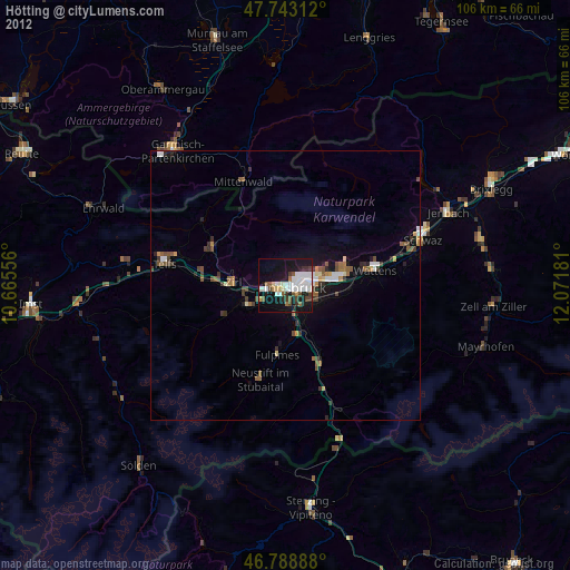
Hötting night lights from space
Night Light of Hötting (Tyrol) from space (Austria) Src. Average luminocity for 10x10km area is 36.7396% and for 50x50km: 4.5598%.
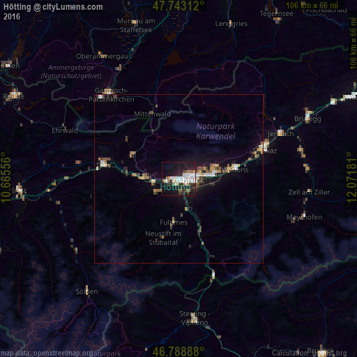
Analysis of Hötting night lights 2016
Square area 10x10 km:
100  8.33%
8.33%
90-99 10.27%
80-89 2.23%
70-79 1.79%
60-69 1.64%
50-59 2.98%
40-49 4.91%
30-39 3.87%
20-29 14.58%
10-19 32.44%
0-9 16.96%
8.33%90-99
10.27%80-89
2.23%70-79
1.79%60-69
1.64%50-59
2.98%40-49
4.91%30-39
3.87%20-29
14.58%10-19
32.44%0-9
16.96%Square area 50x50 km:
100 0.6%
90-99 0.7%
80-89 0.34%
70-79 0.4%
60-69 0.47%
50-59 0.61%
40-49 0.71%
30-39 0.79%
20-29 1.15%
10-19 3.65%
0-9 90.56%
0.6%90-99
0.7%80-89
0.34%70-79
0.4%60-69
0.47%50-59
0.61%40-49
0.71%30-39
0.79%20-29
1.15%10-19
3.65%0-9
90.56%Clear (daylight) street map image can be seen on geolist.org.
Map coordinates:
47° 44' 35.2" North, 10° 39' 56" East
47° 16' 5.3" North, 11° 22' 7.2" East
46° 47' 20" North, 12° 4' 18.5" East
Some cities around Hötting sort by population:
• Innsbruck
2 km =1.2 mi,  107°
107°
• Pradl
3.5 km =2.2 mi,  94°
94°
• Wilten
1.8 km =1.1 mi,  126°
126°
• Arzl
5.2 km =3.2 mi,  70°
70°
• Rum
6.4 km =4 mi, 74°
• Völs
3.3 km =2.1 mi,  232°
232°
• Amras
4.1 km =2.5 mi,  119°
119°
• Mühlau
2.9 km =1.8 mi,  54°
54°
2775479 (p: 35,043)
Sources (retrieved 2019-11-25):
» Earth at Night: Flat Maps 2012, 2016