Ried im Innkreis night lights from space
Night Light of Ried im Innkreis (Upper Austria) from space (Austria) Src. Average luminocity for 10x10km area is 6.0521% and for 50x50km: 1.2231%.
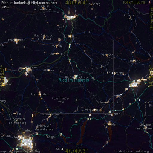
Analysis of Ried im Innkreis night lights 2016
Square area 10x10 km:
 1.19%
1.19%90-99
0.6%80-89
0.6%70-79
0.45%60-69
1.34%50-59
0.6%40-49
1.04%30-39
0.74%20-29
1.79%10-19
0%0-9
91.67%Square area 50x50 km:
0.09%90-99
0.09%80-89
0.09%70-79
0.15%60-69
0.19%50-59
0.21%40-49
0.44%30-39
0.34%20-29
0.25%10-19
0.2%0-9
97.95%Clear (daylight) street map image can be seen on geolist.org.
Map coordinates:
48° 40' 39.5" North, 12° 47' 7.5" East
48° 12' 40.4" North, 13° 29' 18.8" East
47° 44' 25.9" North, 14° 11' 30" East
Some cities around Ried im Innkreis sort by population:
• Pocking, DE
24.8 km =15.4 mi,  328°
328°
• Simbach am Inn, DE
35 km =21.7 mi,  279°
279°
• Laakirchen
35.5 km =22.1 mi,  135°
135°
• Attnang-Puchheim
28.2 km =17.5 mi, 143°
• Bad Griesbach, DE
34.5 km =21.4 mi,  320°
320°
• Bad Füssing, DE
20.3 km =12.6 mi, 319°
• Mattighofen
27.6 km =17.1 mi,  245°
245°
• Rotthalmünster, DE
26.8 km =16.7 mi,  307°
307°
2767471 (p: 11,903)
Sources (retrieved 2019-11-25):
» Earth at Night: Flat Maps 2012, 2016