Puntigam night lights from space
Night Light of Puntigam (Styria) from space (Austria) Src. Average luminocity for 10x10km area is 60.2315% and for 50x50km: 6.7631%.
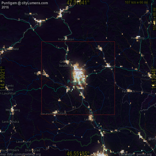
Analysis of Puntigam night lights 2016
Square area 10x10 km:
 11.08%
90-99
18.18%80-89
5.11%70-79
10.51%60-69
7.24%50-59
7.1%40-49
6.68%30-39
7.53%20-29
16.9%10-19
9.66%0-9
0%Square area 50x50 km:
0.79%90-99
1.27%80-89
0.56%70-79
0.87%60-69
0.8%50-59
1.06%40-49
0.96%30-39
1.15%20-29
1.85%10-19
3.87%0-9
86.81%Clear (daylight) street map image can be seen on geolist.org.
Map coordinates:
47° 30' 37.5" North, 14° 43' 48.8" East
47° 1' 60" North, 15° 25' 60" East
46° 33' 7" North, 16° 8' 11.3" East
Some cities around Puntigam sort by population:
• Graz
3.9 km =2.4 mi,  18°
18°
• Jakomini
2.7 km =1.7 mi,  28°
28°
• Gries
3.3 km =2.1 mi,  347°
347°
• Straßgang
2.5 km =1.6 mi,  270°
270°
• Sankt Leonhard
4.4 km =2.7 mi, 24°
• Wetzelsdorf
3.4 km =2.1 mi,  310°
310°
• Sankt Peter
3.1 km =1.9 mi,  53°
53°
• Liebenau
2.5 km =1.6 mi,  90°
90°
2768247 (p: 8,647)
Sources (retrieved 2019-11-25):
» Earth at Night: Flat Maps 2012, 2016