Oberhaid night lights from space
Night Light of Oberhaid (Upper Austria) from space (Austria) Src. Average luminocity for 10x10km area is 30.6071% and for 50x50km: 7.0592%.
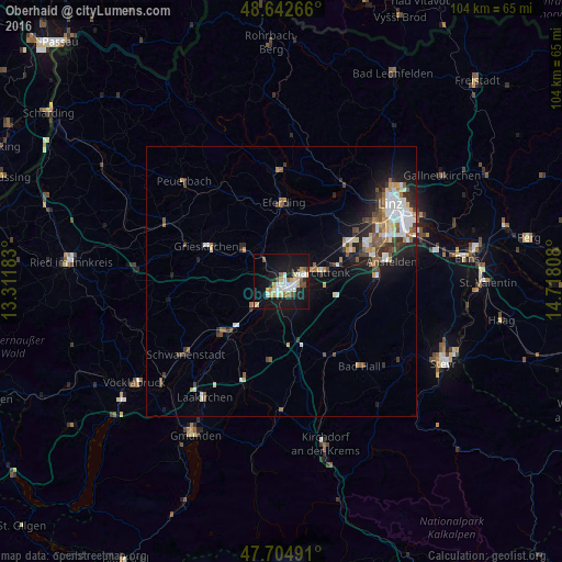
Analysis of Oberhaid night lights 2016
Square area 10x10 km:
 5.95%
5.95%90-99
6.7%80-89
3.57%70-79
3.57%60-69
3.13%50-59
2.08%40-49
2.38%30-39
0.89%20-29
3.72%10-19
39.29%0-9
28.72%Square area 50x50 km:
1.15%90-99
1.38%80-89
0.65%70-79
0.71%60-69
0.69%50-59
0.95%40-49
1.03%30-39
0.92%20-29
1.59%10-19
4.87%0-9
86.05%Clear (daylight) street map image can be seen on geolist.org.
Map coordinates:
48° 38' 33.6" North, 13° 18' 42.6" East
48° 10' 33.3" North, 14° 0' 53.8" East
47° 42' 17.7" North, 14° 43' 5.1" East
Some cities around Oberhaid sort by population:
• Wels
1.7 km =1.1 mi,  127°
127°
• Traun
17.3 km =10.7 mi,  73°
73°
• Marchtrenk
7.2 km =4.5 mi,  77°
77°
• Haid
17.8 km =11.1 mi, 79°
• Kremsmünster
16.1 km =10 mi,  148°
148°
• Neuhofen an der Krems
16.3 km =10.1 mi,  104°
104°
• Lichtenegg
3.1 km =1.9 mi,  201°
201°
• Wimpassing
2.6 km =1.6 mi,  246°
246°
11694981 (p: 5,100)
Sources (retrieved 2019-11-25):
» Earth at Night: Flat Maps 2012, 2016