Kitzbühel night lights from space
Night Light of Kitzbühel (Tyrol) from space (Austria) Src. Average luminocity for 10x10km area is 4.2188% and for 50x50km: 1.221%.
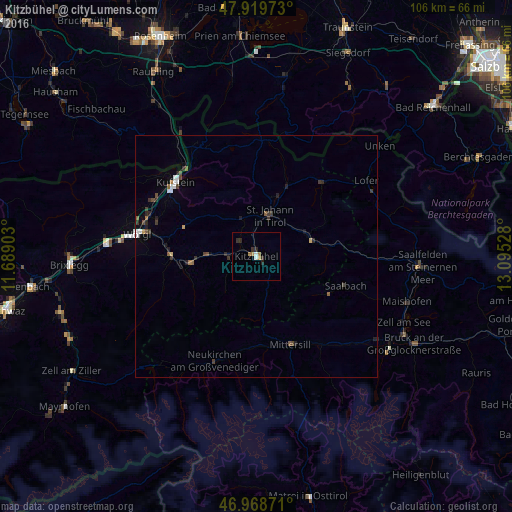
Analysis of Kitzbühel night lights 2016
Square area 10x10 km:
 0.57%
0.57%90-99
0.57%80-89
0%70-79
0.57%60-69
1.56%50-59
0.14%40-49
0%30-39
1.14%20-29
2.27%10-19
0%0-9
93.18%Square area 50x50 km:
0.2%90-99
0.13%80-89
0.05%70-79
0.07%60-69
0.15%50-59
0.18%40-49
0.21%30-39
0.36%20-29
0.42%10-19
0.21%0-9
98.02%Clear (daylight) street map image can be seen on geolist.org.
Map coordinates:
47° 55' 11" North, 11° 41' 20.5" East
47° 26' 46.9" North, 12° 23' 31.7" East
46° 58' 7.4" North, 13° 5' 43" East
Some cities around Kitzbühel sort by population:
• Wörgl
25.3 km =15.7 mi,  280°
280°
• Kufstein
22.8 km =14.2 mi,  311°
311°
• Sankt Johann in Tirol
8.9 km =5.5 mi,  15°
15°
• Saalfelden am Steinernen Meer
34.4 km =21.4 mi,  93°
93°
• Zell am See
33.5 km =20.8 mi,  114°
114°
• Kiefersfelden, DE
24 km =14.9 mi,  320°
320°
• Kirchbichl
23.6 km =14.7 mi,  289°
289°
• Kirchberg in Tirol
5.7 km =3.5 mi,  268°
268°
2774347 (p: 8,272)
Sources (retrieved 2019-11-25):
» Earth at Night: Flat Maps 2012, 2016