Groß-Enzersdorf night lights from space
Night Light of Groß-Enzersdorf (Lower Austria) from space (Austria) Src. Average luminocity for 10x10km area is 35.9107% and for 50x50km: 25.9808%.
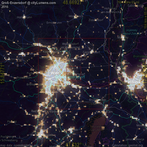
Analysis of Groß-Enzersdorf night lights 2016
Square area 10x10 km:
 3.57%
3.57%90-99
5.51%80-89
5.36%70-79
2.98%60-69
5.51%50-59
7.44%40-49
4.61%30-39
12.05%20-29
12.65%10-19
16.52%0-9
23.81%Square area 50x50 km:
6.51%90-99
5.53%80-89
2.19%70-79
2.82%60-69
3.19%50-59
2.66%40-49
2.4%30-39
3.39%20-29
6.61%10-19
10.54%0-9
54.17%Clear (daylight) street map image can be seen on geolist.org.
Map coordinates:
48° 40' 9.4" North, 15° 50' 51.8" East
48° 12' 10" North, 16° 33' 3" East
47° 43' 55.2" North, 17° 15' 14.3" East
Some cities around Groß-Enzersdorf sort by population:
• Vienna
13.3 km =8.3 mi,  272°
272°
• Favoriten
13.3 km =8.3 mi,  249°
249°
• Donaustadt
7.5 km =4.7 mi,  296°
296°
• Floridsdorf
12.3 km =7.6 mi, 295°
• Simmering
9 km =5.6 mi,  256°
256°
• Schwechat
9.9 km =6.2 mi,  218°
218°
• Gerasdorf bei Wien
11.9 km =7.4 mi,  328°
328°
• Deutsch-Wagram
10.8 km =6.7 mi,  6°
6°
2777836 (p: 6,616)
Sources (retrieved 2019-11-25):
» Earth at Night: Flat Maps 2012, 2016