Justo Daract night lights from space
Night Light of Justo Daract (San Luis) from space (Argentina) Src. Average luminocity for 10x10km area is 14.6206% and for 50x50km: 2.3013%.
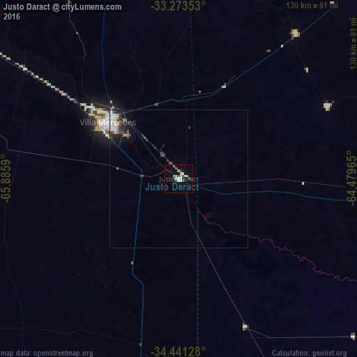
Analysis of Justo Daract night lights 2016
Square area 10x10 km:
 1.92%
1.92%90-99
1.57%80-89
3.85%70-79
1.57%60-69
0.35%50-59
1.92%40-49
2.27%30-39
2.27%20-29
0.35%10-19
1.05%0-9
82.87%Square area 50x50 km:
0.36%90-99
0.43%80-89
0.25%70-79
0.17%60-69
0.19%50-59
0.18%40-49
0.41%30-39
0.71%20-29
0.48%10-19
1.12%0-9
95.71%Clear (daylight) street map image can be seen on geolist.org.
Map coordinates:
33° 16' 24.7" South, 65° 53' 9.2" West
33° 51' 33.8" South, 65° 10' 58" West
34° 26' 28.6" South, 64° 28' 46.7" West
Some cities around Justo Daract sort by population:
• Río Cuarto
111.9 km =69.5 mi,  43°
43°
• Villa Mercedes
32.6 km =20.3 mi,  308°
308°
• Vicuña Mackenna
73.3 km =45.5 mi,  95°
95°
• Coronel Moldes
60.2 km =37.4 mi,  64°
64°
• Sampacho
67.9 km =42.2 mi, 38°
• La Toma
98.6 km =61.3 mi,  335°
335°
• Adelia María
110.4 km =68.6 mi,  76°
76°
• General Levalle
117.4 km =72.9 mi, 98°
3853330 (p: 9,680)
Sources (retrieved 2019-11-25):
» Earth at Night: Flat Maps 2012, 2016