Ingeniero Luis A. Huergo night lights from space
Night Light of Ingeniero Luis A. Huergo (Rio Negro) from space (Argentina) Src. Average luminocity for 10x10km area is 7.6916% and for 50x50km: 2.5952%.
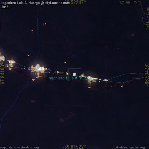
Analysis of Ingeniero Luis A. Huergo night lights 2016
Square area 10x10 km:
 1.79%
1.79%90-99
0.81%80-89
1.14%70-79
0.32%60-69
1.14%50-59
0.16%40-49
0.49%30-39
0.81%20-29
1.14%10-19
0.32%0-9
91.88%Square area 50x50 km:
0.32%90-99
0.21%80-89
0.28%70-79
0.29%60-69
0.43%50-59
0.21%40-49
0.4%30-39
0.4%20-29
0.56%10-19
2.23%0-9
94.69%Clear (daylight) street map image can be seen on geolist.org.
Map coordinates:
38° 31' 24.5" South, 67° 56' 27.7" West
39° 4' 17.3" South, 67° 14' 16.4" West
39° 36' 54.8" South, 66° 32' 5.2" West
Some cities around Ingeniero Luis A. Huergo sort by population:
• Neuquén
72.2 km =44.9 mi,  280°
280°
• Cipolletti
66.8 km =41.5 mi, 283°
• General Roca
30.1 km =18.7 mi, 278°
• Villa Regina
15.1 km =9.4 mi,  102°
102°
• Allen
52 km =32.3 mi, 281°
• Cinco Saltos
76.5 km =47.5 mi,  291°
291°
• General Fernández Oro
60.8 km =37.8 mi, 282°
• Cervantes
13.6 km =8.5 mi, 277°
3853782 (p: 6,483)
Sources (retrieved 2019-11-25):
» Earth at Night: Flat Maps 2012, 2016