Cipolletti night lights from space
Night Light of Cipolletti (Rio Negro) from space (Argentina) Src. Average luminocity for 10x10km area is 65.6446% and for 50x50km: 14.9151%.
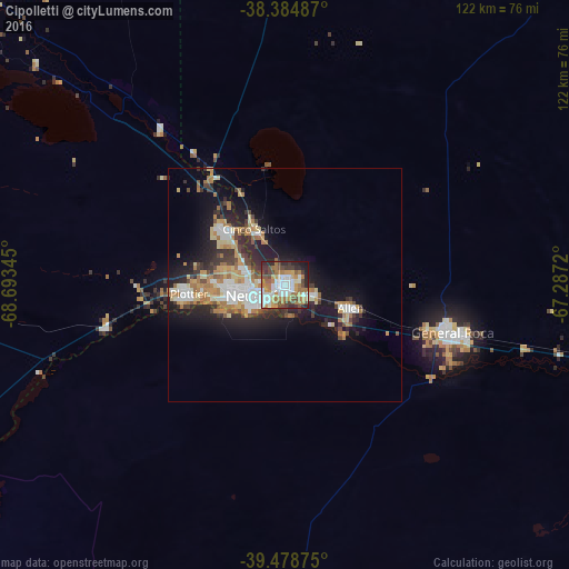
Analysis of Cipolletti night lights 2016
Square area 10x10 km:
 13.61%
90-99
16.67%80-89
3.23%70-79
9.35%60-69
21.09%50-59
4.25%40-49
11.22%30-39
7.14%20-29
8.84%10-19
4.59%0-9
0%Square area 50x50 km:
2.26%90-99
2.55%80-89
1.55%70-79
2.05%60-69
3.49%50-59
0.93%40-49
1.79%30-39
2.22%20-29
4.51%10-19
9.02%0-9
69.64%Clear (daylight) street map image can be seen on geolist.org.
Map coordinates:
38° 23' 5.5" South, 68° 41' 36.4" West
38° 56' 2.1" South, 67° 59' 25.2" West
39° 28' 43.5" South, 67° 17' 13.9" West
Some cities around Cipolletti sort by population:
• Neuquén
6.3 km =3.9 mi,  251°
251°
• General Roca
36.9 km =22.9 mi,  107°
107°
• Centenario
16.9 km =10.5 mi,  313°
313°
• Allen
14.9 km =9.3 mi, 108°
• Plottier
21.3 km =13.2 mi,  260°
260°
• Cinco Saltos
13.9 km =8.6 mi,  333°
333°
• General Fernández Oro
6 km =3.7 mi, 110°
• Senillosa
39.3 km =24.4 mi, 256°
3861056 (p: 75,078)
Sources (retrieved 2019-11-25):
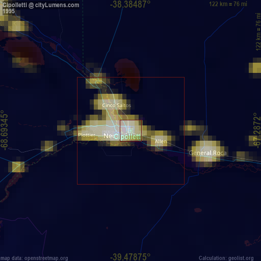
» NASA, Earths city lights 1995
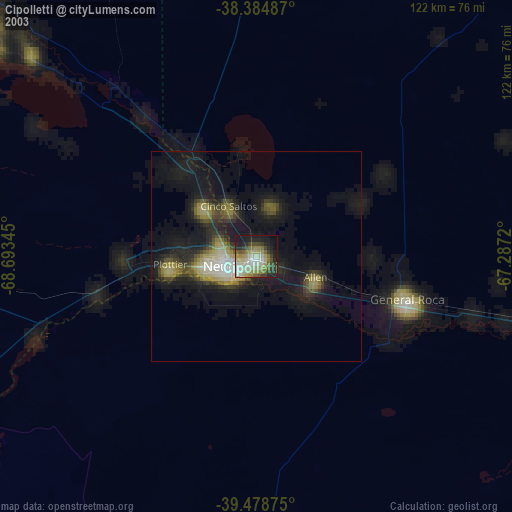
» NASA city lights 2003
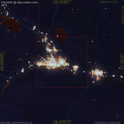
» Earth at Night: Flat Maps 2012, 2016