General Roca night lights from space
Night Light of General Roca (Rio Negro) from space (Argentina) Src. Average luminocity for 10x10km area is 55.8945% and for 50x50km: 4.8255%.
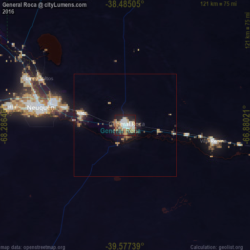

Analysis of General Roca night lights 2016
Square area 10x10 km:
 13.31%
90-99
10.71%80-89
8.93%70-79
7.14%60-69
11.36%50-59
2.27%40-49
3.25%30-39
5.52%20-29
21.27%10-19
16.07%0-9
0.16%Square area 50x50 km:
0.68%90-99
0.6%80-89
0.59%70-79
0.66%60-69
0.99%50-59
0.29%40-49
0.48%30-39
0.52%20-29
1.57%10-19
3.9%0-9
89.72%Clear (daylight) street map image can be seen on geolist.org.
Map coordinates:
38° 29' 6.2" South, 68° 17' 11.3" West
39° 1' 60" South, 67° 34' 60" West
39° 34' 38.6" South, 66° 52' 48.8" West
Some cities around General Roca sort by population:
• Neuquén
42.1 km =26.2 mi,  282°
282°
• Cipolletti
36.9 km =22.9 mi,  287°
287°
• Villa Regina
45.2 km =28.1 mi,  99°
99°
• Centenario
52.6 km =32.7 mi,  295°
295°
• Allen
22 km =13.7 mi, 286°
• Cinco Saltos
47.7 km =29.6 mi, 299°
• Ingeniero Luis A. Huergo
30.1 km =18.7 mi, 98°
• Cervantes
16.5 km =10.3 mi, 98°
3855065 (p: 73,212)
Sources (retrieved 2019-11-25):
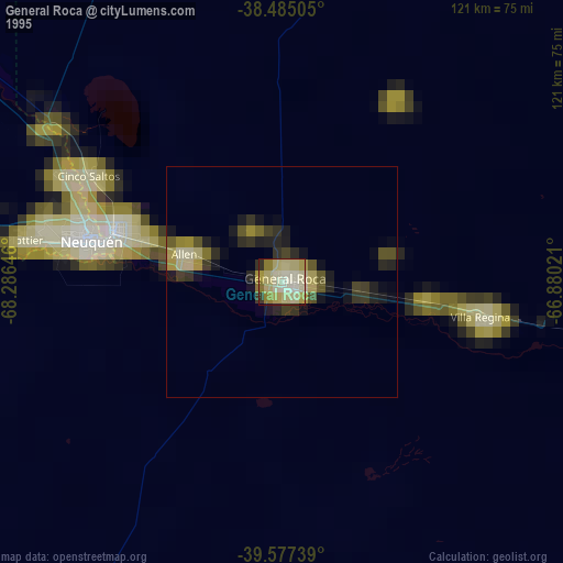
» NASA, Earths city lights 1995
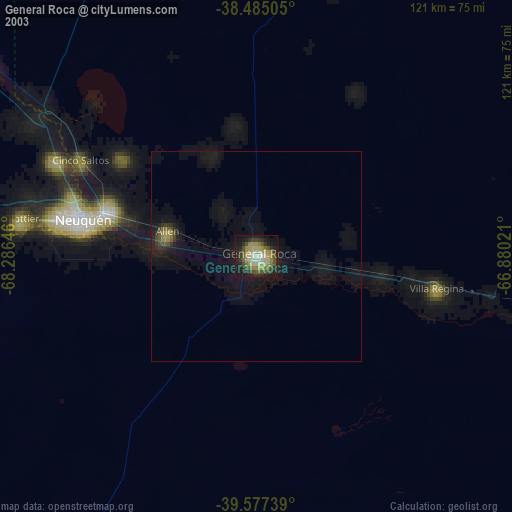
» NASA city lights 2003
» Earth at Night: Flat Maps 2012, 2016