Centenario night lights from space
Night Light of Centenario (Neuquen) from space (Argentina) Src. Average luminocity for 10x10km area is 45.4728% and for 50x50km: 15.6082%.
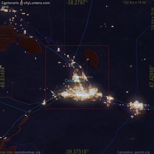
Analysis of Centenario night lights 2016
Square area 10x10 km:
 4.93%
4.93%90-99
5.95%80-89
10.71%70-79
6.63%60-69
8.33%50-59
1.02%40-49
5.44%30-39
9.35%20-29
23.98%10-19
22.96%0-9
0.68%Square area 50x50 km:
2.29%90-99
2.55%80-89
1.63%70-79
2.12%60-69
3.6%50-59
1.02%40-49
1.94%30-39
2.47%20-29
4.7%10-19
9.34%0-9
68.35%Clear (daylight) street map image can be seen on geolist.org.
Map coordinates:
38° 16' 46.9" South, 68° 50' 5.7" West
38° 49' 46.4" South, 68° 7' 54.5" West
39° 22' 30.6" South, 67° 25' 43.2" West
Some cities around Centenario sort by population:
• Neuquén
15 km =9.3 mi,  155°
155°
• Cipolletti
16.9 km =10.5 mi,  133°
133°
• General Roca
52.6 km =32.7 mi,  115°
115°
• Allen
31.1 km =19.3 mi, 121°
• Plottier
17.6 km =10.9 mi,  209°
209°
• Cinco Saltos
6 km =3.7 mi,  82°
82°
• General Fernández Oro
22.6 km =14 mi, 127°
• Senillosa
33.2 km =20.6 mi,  231°
231°
3862144 (p: 28,956)
Sources (retrieved 2019-11-25):
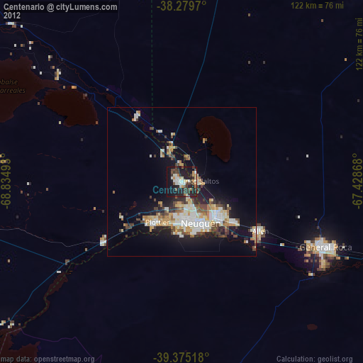
» Earth at Night: Flat Maps 2012, 2016