Capilla del Monte night lights from space
Night Light of Capilla del Monte (Cordoba) from space (Argentina) Src. Average luminocity for 10x10km area is 6.6469% and for 50x50km: 2.0758%.
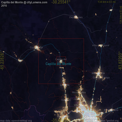
Analysis of Capilla del Monte night lights 2016
Square area 10x10 km:
 0.52%
0.52%90-99
0.17%80-89
0%70-79
1.05%60-69
2.1%50-59
1.75%40-49
1.57%30-39
1.92%20-29
0%10-19
1.4%0-9
89.51%Square area 50x50 km:
0.08%90-99
0.02%80-89
0.21%70-79
0.16%60-69
0.64%50-59
0.4%40-49
0.38%30-39
0.62%20-29
0.33%10-19
1.39%0-9
95.77%Clear (daylight) street map image can be seen on geolist.org.
Map coordinates:
30° 15' 19.5" South, 65° 13' 41.8" West
30° 51' 39.2" South, 64° 31' 30.5" West
31° 27' 45.2" South, 63° 49' 19.3" West
Some cities around Capilla del Monte sort by population:
• Cruz del Eje
30.5 km =19 mi,  299°
299°
• Cosquín
43.1 km =26.8 mi,  172°
172°
• Río Ceballos
38.9 km =24.2 mi,  150°
150°
• La Falda
25.5 km =15.8 mi, 172°
• La Cumbre
13.8 km =8.6 mi, 166°
• Salsipuedes
37.7 km =23.4 mi,  144°
144°
• Huerta Grande
24.1 km =15 mi, 172°
• Valle Hermoso
28.8 km =17.9 mi, 171°
3862761 (p: 9,085)
Sources (retrieved 2019-11-25):
» Earth at Night: Flat Maps 2012, 2016