Berat night lights from space
Night Light of Berat from space (Albania) Src. Average luminocity for 10x10km area is 11.6039% and for 50x50km: 1.8908%.
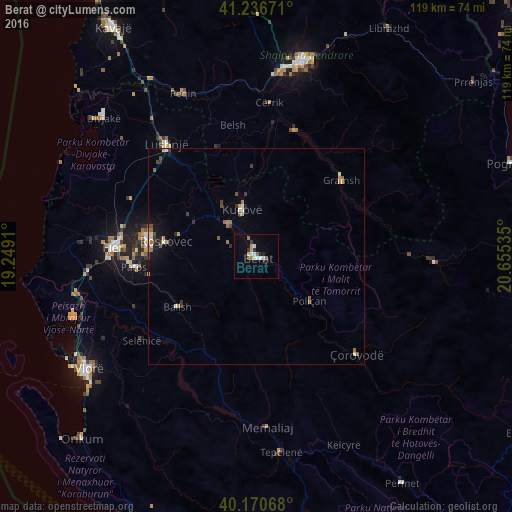
Analysis of Berat night lights 2016
Square area 10x10 km:
100  1.62%
1.62%
90-99 2.27%
80-89 1.3%
70-79 1.3%
60-69 1.3%
50-59 0.32%
40-49 1.62%
30-39 0.97%
20-29 1.95%
10-19 1.62%
0-9 85.71%
1.62%90-99
2.27%80-89
1.3%70-79
1.3%60-69
1.3%50-59
0.32%40-49
1.62%30-39
0.97%20-29
1.95%10-19
1.62%0-9
85.71%Square area 50x50 km:
100 0.13%
90-99 0.31%
80-89 0.14%
70-79 0.23%
60-69 0.34%
50-59 0.26%
40-49 0.28%
30-39 0.32%
20-29 0.27%
10-19 0.79%
0-9 96.94%
0.13%90-99
0.31%80-89
0.14%70-79
0.23%60-69
0.34%50-59
0.26%40-49
0.28%30-39
0.32%20-29
0.27%10-19
0.79%0-9
96.94%Clear (daylight) street map image can be seen on geolist.org.
Map coordinates:
41° 14' 12.2" North, 19° 14' 56.8" East
40° 42' 21" North, 19° 57' 8" East
40° 10' 14.4" North, 20° 39' 19.3" East
Some cities around Berat sort by population:
• Patos
28.2 km =17.5 mi,  264°
264°
• Patos Fshat
26.4 km =16.4 mi,  254°
254°
• Kuçovë
10.9 km =6.8 mi,  344°
344°
• Çorovodë
32.3 km =20.1 mi,  134°
134°
• Gramsh
26.7 km =16.6 mi,  47°
47°
• Poliçan
16.1 km =10 mi, 130°
• Ballsh
21.9 km =13.6 mi,  237°
237°
• Roskovec
21.4 km =13.3 mi,  279°
279°
3186084 (p: 46,866)
Sources (retrieved 2019-11-25):
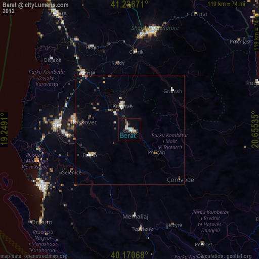
» Earth at Night: Flat Maps 2012, 2016