Khawr Fakkān night lights from space
Night Light of Khawr Fakkān (Sharjah) from space (United Arab Emirates) Src. Average luminocity for 10x10km area is 62.4802% and for 50x50km: 22.6329%.
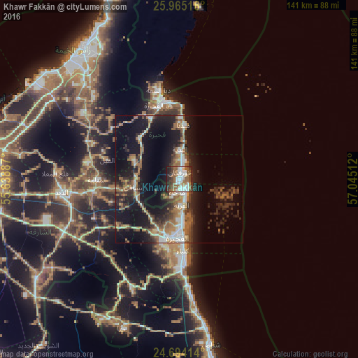
Analysis of Khawr Fakkān night lights 2016
Square area 10x10 km:
 15.48%
90-99
14.48%80-89
2.98%70-79
0.6%60-69
16.27%50-59
16.87%40-49
7.74%30-39
9.13%20-29
12.9%10-19
3.57%0-9
0%Square area 50x50 km:
2.65%90-99
3.18%80-89
1.81%70-79
1.55%60-69
5.03%50-59
4.63%40-49
2.68%30-39
4.71%20-29
7.28%10-19
19.74%0-9
46.74%Clear (daylight) street map image can be seen on geolist.org.
Map coordinates:
25° 57' 54.6" North, 55° 38' 19.9" East
25° 19' 52.8" North, 56° 20' 31.2" East
24° 41' 38.9" North, 57° 2' 42.4" East
Some cities around Khawr Fakkān sort by population:
• Ras Al Khaimah City
64.8 km =40.3 mi,  321°
321°
• Al Fujairah City
23.9 km =14.9 mi,  180°
180°
• Reef Al Fujairah City
22.8 km =14.2 mi,  204°
204°
• Umm Al Quwain City
83.2 km =51.7 mi,  288°
288°
• Shināş, OM
66.7 km =41.4 mi,  169°
169°
• Dibba Al-Fujairah
30.1 km =18.7 mi,  344°
344°
• Dibba Al-Hisn
32.8 km =20.4 mi,  347°
347°
• Adh Dhayd
46.5 km =28.9 mi,  264°
264°
291696 (p: 40,677)
Sources (retrieved 2019-11-25):
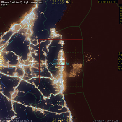
» Earth at Night: Flat Maps 2012, 2016