Hermanus night lights from space
Night Light of Hermanus (Western Cape) from space (South Africa) Src. Average luminocity for 10x10km area is 18.7587% and for 50x50km: 2.4301%.
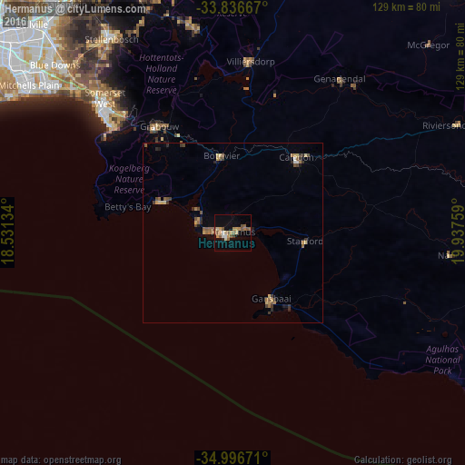
Analysis of Hermanus night lights 2016
Square area 10x10 km:
 1.05%
1.05%90-99
1.75%80-89
2.27%70-79
4.9%60-69
2.27%50-59
6.47%40-49
1.22%30-39
0.7%20-29
0.7%10-19
10.84%0-9
67.83%Square area 50x50 km:
0.06%90-99
0.13%80-89
0.37%70-79
0.43%60-69
0.39%50-59
0.7%40-49
0.34%30-39
0.46%20-29
0.32%10-19
0.77%0-9
96.03%Clear (daylight) street map image can be seen on geolist.org.
Map coordinates:
33° 50' 12" South, 18° 31' 52.8" East
34° 25' 7.3" South, 19° 14' 4.1" East
34° 59' 48.2" South, 19° 56' 15.3" East
Some cities around Hermanus sort by population:
• Paarl
79.8 km =49.6 mi,  342°
342°
• Stellenbosch
63.6 km =39.5 mi,  327°
327°
• Kraaifontein
79.3 km =49.3 mi,  323°
323°
• Retreat
80.6 km =50.1 mi,  300°
300°
• Grabouw
35.9 km =22.3 mi, 325°
• Lansdowne
83 km =51.6 mi,  305°
305°
• Bredasdorp
74.9 km =46.5 mi,  99°
99°
• Claremont
85.9 km =53.4 mi, 304°
3366880 (p: 25,153)
Sources (retrieved 2019-11-25):
» Earth at Night: Flat Maps 2012, 2016