Novo Brdo night lights from space
Night Light of Novo Brdo (Pristina) from space (Kosovo) Src. Average luminocity for 10x10km area is 0% and for 50x50km: 3.4729%.
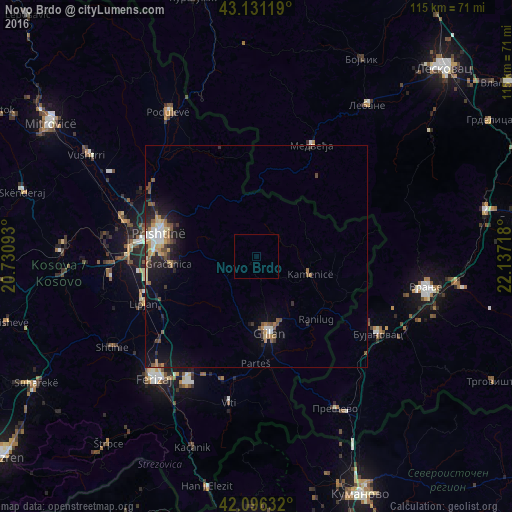
Analysis of Novo Brdo night lights 2016
Square area 10x10 km:
 0%
0%90-99
0%80-89
0%70-79
0%60-69
0%50-59
0%40-49
0%30-39
0%20-29
0%10-19
0%0-9
100%Square area 50x50 km:
0.38%90-99
0.38%80-89
0.33%70-79
0.53%60-69
0.47%50-59
0.59%40-49
0.49%30-39
0.56%20-29
0.93%10-19
2.6%0-9
92.74%Clear (daylight) street map image can be seen on geolist.org.
Map coordinates:
43° 7' 52.3" North, 20° 43' 51.3" East
42° 36' 57.2" North, 21° 26' 2.6" East
42° 5' 46.8" North, 22° 8' 13.8" East
Some cities around Novo Brdo sort by population:
• Pristina
22.7 km =14.1 mi,  286°
286°
• Ferizaj
35.6 km =22.1 mi,  219°
219°
• Gjilan
17.5 km =10.9 mi,  170°
170°
• Vitina
33.3 km =20.7 mi,  190°
190°
• Kosovo Polje
28.2 km =17.5 mi,  280°
280°
• Obiliq
30.8 km =19.1 mi, 284°
• Kamenica
12.7 km =7.9 mi,  109°
109°
• Lipljan
27.3 km =17 mi,  247°
247°
787589 (p: 6,720)
Sources (retrieved 2019-11-25):
» Earth at Night: Flat Maps 2012, 2016