Sông Cầu night lights from space
Night Light of Sông Cầu (Phú Yên) from space (Vietnam) Src. Average luminocity for 10x10km area is 13.1054% and for 50x50km: 2.7508%.
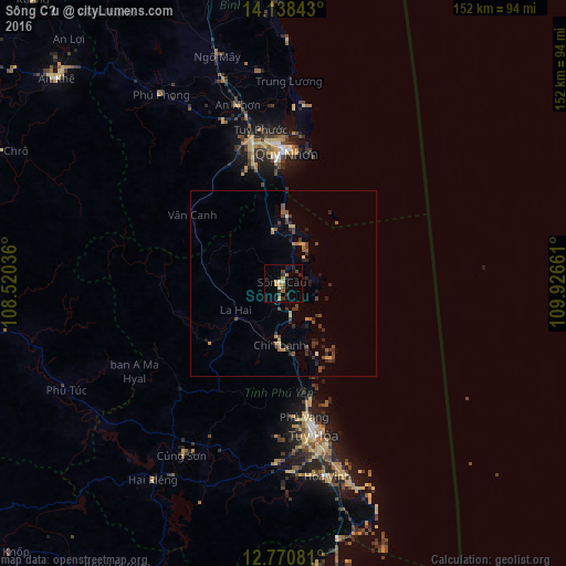
Analysis of Sông Cầu night lights 2016
Square area 10x10 km:
 0.41%
0.41%90-99
0.41%80-89
2.48%70-79
1.86%60-69
2.27%50-59
1.45%40-49
3.51%30-39
2.07%20-29
3.1%10-19
3.93%0-9
78.51%Square area 50x50 km:
0.02%90-99
0.07%80-89
0.26%70-79
0.39%60-69
0.38%50-59
0.4%40-49
0.85%30-39
0.88%20-29
0.92%10-19
0.74%0-9
95.07%Clear (daylight) street map image can be seen on geolist.org.
Map coordinates:
14° 8' 18.3" North, 108° 31' 13.3" East
13° 27' 20.2" North, 109° 13' 24.5" East
12° 46' 14.9" North, 109° 55' 35.8" East
Some cities around Sông Cầu sort by population:
• Nha Trang
134.6 km =83.6 mi,  181°
181°
• Qui Nhon
35.7 km =22.2 mi,  0°
0°
• Ðà Lạt
188 km =116.8 mi,  206°
206°
• Buôn Ma Thuột
155.5 km =96.6 mi,  235°
235°
• Cam Ranh
170.7 km =106.1 mi, 182°
• Pleiku
144.6 km =89.9 mi,  293°
293°
• Tuy Hòa
41.4 km =25.7 mi,  165°
165°
• Kon Tum
165 km =102.5 mi,  307°
307°
1567723 (p: 94,066)
Sources (retrieved 2019-11-25):
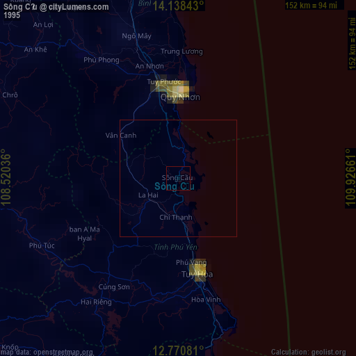
» NASA, Earths city lights 1995
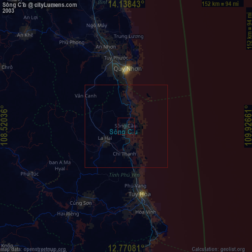
» NASA city lights 2003
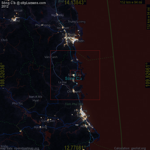
» Earth at Night: Flat Maps 2012, 2016