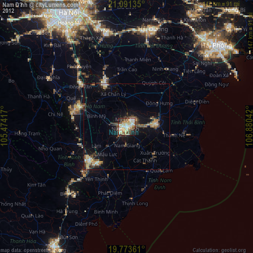
Nam Định night lights from space
Night Light of Nam Định from space (Vietnam) Src. Average luminocity for 10x10km area is 65.6023% and for 50x50km: 11.7977%.

Analysis of Nam Định night lights 2016
Square area 10x10 km:
 10.61%
90-99
17.23%80-89
10.61%70-79
11.55%60-69
8.9%50-59
9.28%40-49
8.33%30-39
11.55%20-29
7.01%10-19
4.92%0-9
0%Square area 50x50 km:
0.89%90-99
1.32%80-89
1.52%70-79
1.4%60-69
1.86%50-59
2.31%40-49
1.9%30-39
2.26%20-29
2.83%10-19
10.18%0-9
73.53%Clear (daylight) street map image can be seen on geolist.org.
Map coordinates:
21° 5' 28.9" North, 105° 28' 27" East
20° 26' 2" North, 106° 10' 38.2" East
19° 46' 25" North, 106° 52' 49.5" East
Some cities around Nam Định sort by population:
• Haiphong
71.2 km =44.2 mi,  47°
47°
• Hải Dương
58.7 km =36.5 mi,  16°
16°
• Bỉm Sơn
51.6 km =32.1 mi,  219°
219°
• Thái Bình
17 km =10.6 mi,  83°
83°
• Hà Đông
72.7 km =45.2 mi,  325°
325°
• Hưng Yên
27 km =16.8 mi, 330°
• Ninh Bình
28.4 km =17.6 mi,  226°
226°
• Phủ Lý
30.3 km =18.8 mi,  294°
294°
1573517 (p: 193,499)
Sources (retrieved 2019-11-25):
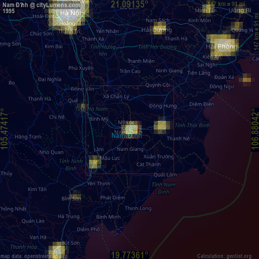
» NASA, Earths city lights 1995
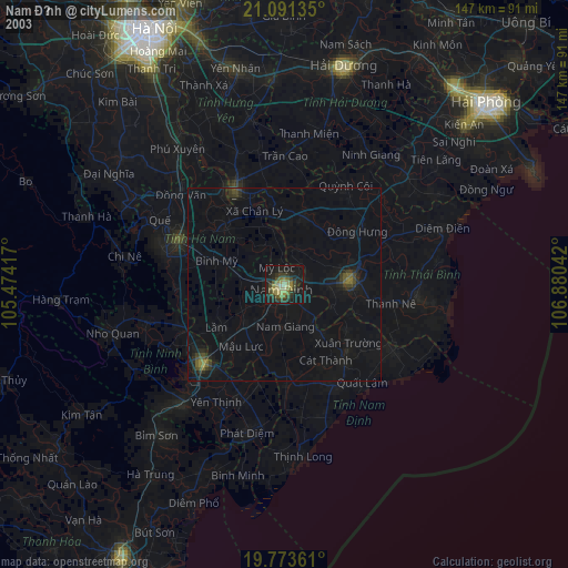
» NASA city lights 2003
» Earth at Night: Flat Maps 2012, 2016