Yorkshire night lights from space
Night Light of Yorkshire (Virginia) from space (United States) Src. Average luminocity for 10x10km area is 72.0833% and for 50x50km: 49.9335%.
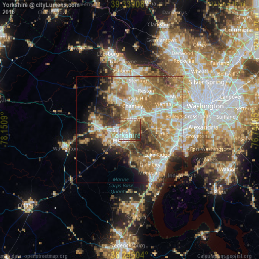
Analysis of Yorkshire night lights 2016
Square area 10x10 km:
 15.48%
90-99
15.48%80-89
10.37%70-79
11.22%60-69
16.84%50-59
12.93%40-49
9.69%30-39
3.91%20-29
4.08%10-19
0%0-9
0%Square area 50x50 km:
9.3%90-99
10.22%80-89
6.5%70-79
10.33%60-69
10.69%50-59
6.69%40-49
4.69%30-39
5.7%20-29
6.51%10-19
6.98%0-9
22.38%Clear (daylight) street map image can be seen on geolist.org.
Map coordinates:
39° 20' 20.7" North, 78° 9' 3.2" West
38° 47' 35.4" North, 77° 26' 52" West
38° 14' 34.9" North, 76° 44' 40.7" West
Some cities around Yorkshire sort by population:
• Centreville
5.5 km =3.4 mi,  17°
17°
• Manassas
5.3 km =3.3 mi,  206°
206°
• Buckhall
7 km =4.3 mi,  168°
168°
• Sudley
4.3 km =2.7 mi,  269°
269°
• Manassas Park
2.2 km =1.4 mi,  241°
241°
• Bull Run
6.4 km =4 mi,  260°
260°
• Greenbriar
9.8 km =6.1 mi, 24°
• West Gate
4.5 km =2.8 mi, 255°
4794966 (p: 7,541)
Sources (retrieved 2019-11-25):
» Earth at Night: Flat Maps 2012, 2016