Woodlawn night lights from space
Night Light of Woodlawn (Virginia) from space (United States) Src. Average luminocity for 10x10km area is 67.6054% and for 50x50km: 60.7876%.
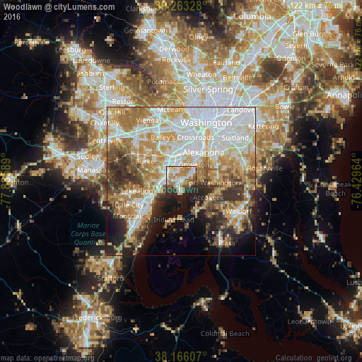
Analysis of Woodlawn night lights 2016
Square area 10x10 km:
 16.16%
90-99
15.31%80-89
9.52%70-79
12.41%60-69
10.03%50-59
9.18%40-49
3.74%30-39
6.8%20-29
14.97%10-19
1.87%0-9
0%Square area 50x50 km:
17.4%90-99
12.64%80-89
8.43%70-79
10.04%60-69
9.31%50-59
5.92%40-49
4.88%30-39
5.7%20-29
7.25%10-19
7.56%0-9
10.88%Clear (daylight) street map image can be seen on geolist.org.
Map coordinates:
39° 15' 47.8" North, 77° 50' 9.2" West
38° 43' 0.4" North, 77° 7' 57.9" West
38° 9' 57.9" North, 76° 25' 46.7" West
Some cities around Woodlawn sort by population:
• Rose Hill
8.2 km =5.1 mi,  12°
12°
• Franconia
7.4 km =4.6 mi,  350°
350°
• Fort Hunt
6.7 km =4.2 mi,  74°
74°
• Hybla Valley
5.5 km =3.4 mi,  51°
51°
• Groveton
7 km =4.3 mi,  36°
36°
• Newington
5.1 km =3.2 mi,  298°
298°
• Mount Vernon
2.8 km =1.7 mi,  96°
96°
• Fort Belvoir
1.3 km =0.8 mi,  244°
244°
4794531 (p: 20,804)
Sources (retrieved 2019-11-25):
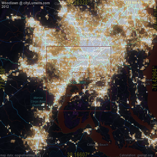
» Earth at Night: Flat Maps 2012, 2016