Dinuba night lights from space
Night Light of Dinuba (California) from space (United States) Src. Average luminocity for 10x10km area is 24.9542% and for 50x50km: 11.8621%.
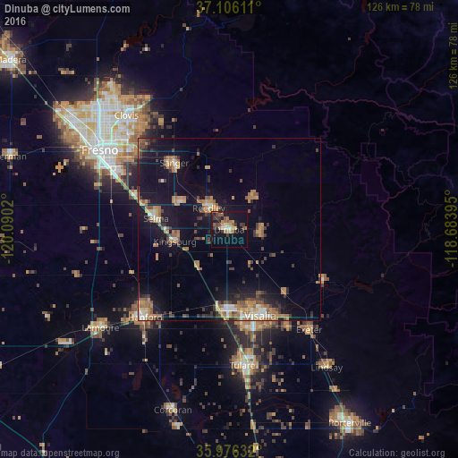
Analysis of Dinuba night lights 2016
Square area 10x10 km:
 1.47%
1.47%90-99
1.83%80-89
1.47%70-79
6.23%60-69
3.66%50-59
6.59%40-49
2.2%30-39
5.49%20-29
2.38%10-19
30.59%0-9
38.1%Square area 50x50 km:
0.82%90-99
1.09%80-89
0.66%70-79
2.41%60-69
2.32%50-59
2.12%40-49
1.56%30-39
2.28%20-29
1.97%10-19
10.98%0-9
73.79%Clear (daylight) street map image can be seen on geolist.org.
Map coordinates:
37° 6' 22" North, 120° 5' 24.7" West
36° 32' 35.8" North, 119° 23' 13.5" West
35° 58' 34.8" North, 118° 41' 2.2" West
Some cities around Dinuba sort by population:
• Visalia
25.2 km =15.7 mi,  160°
160°
• Reedley
8.2 km =5.1 mi,  316°
316°
• Sanger
23.7 km =14.7 mi, 320°
• Selma
20.3 km =12.6 mi,  278°
278°
• Parlier
14.6 km =9.1 mi,  301°
301°
• Kingsburg
15.3 km =9.5 mi,  257°
257°
• Orange Cove
11.1 km =6.9 mi,  35°
35°
• Orosi
8.9 km =5.5 mi,  88°
88°
5343171 (p: 23,702)
Sources (retrieved 2019-11-25):
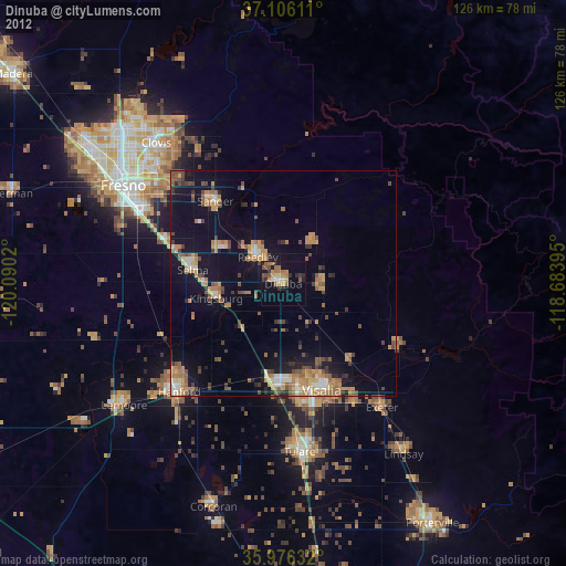
» Earth at Night: Flat Maps 2012, 2016