Barberton night lights from space
Night Light of Barberton (Washington) from space (United States) Src. Average luminocity for 10x10km area is 70.1985% and for 50x50km: 34.861%.
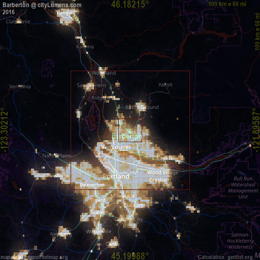
Analysis of Barberton night lights 2016
Square area 10x10 km:
 13.18%
90-99
17.73%80-89
13.79%70-79
17.12%60-69
7.73%50-59
5.3%40-49
5.61%30-39
4.7%20-29
14.85%10-19
0%0-9
0%Square area 50x50 km:
9.58%90-99
9.91%80-89
4.31%70-79
4.27%60-69
3.46%50-59
2.84%40-49
2.85%30-39
2.38%20-29
4.4%10-19
7.46%0-9
48.54%Clear (daylight) street map image can be seen on geolist.org.
Map coordinates:
46° 10' 55.7" North, 123° 18' 7.6" West
45° 41' 35.4" North, 122° 35' 56.4" West
45° 11' 59.6" North, 121° 53' 45.1" West
Some cities around Barberton sort by population:
• Salmon Creek
4.3 km =2.7 mi,  296°
296°
• Orchards
4.2 km =2.6 mi,  135°
135°
• Hazel Dell
5.5 km =3.4 mi,  244°
244°
• Five Corners
2.1 km =1.3 mi,  117°
117°
• Walnut Grove
2.8 km =1.7 mi,  180°
180°
• Minnehaha
5.4 km =3.4 mi,  225°
225°
• Mount Vista
5.3 km =3.3 mi,  330°
330°
• Lake Shore
7.1 km =4.4 mi,  267°
267°
5786322 (p: 5,661)
Sources (retrieved 2019-11-25):
» Earth at Night: Flat Maps 2012, 2016