Upper Grand Lagoon night lights from space
Night Light of Upper Grand Lagoon (Florida) from space (United States) Src. Average luminocity for 10x10km area is 56.1591% and for 50x50km: 15.2466%.
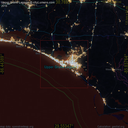
Analysis of Upper Grand Lagoon night lights 2016
Square area 10x10 km:
 12.76%
90-99
15.91%80-89
2.45%70-79
11.01%60-69
6.29%50-59
0.7%40-49
5.59%30-39
12.06%20-29
17.66%10-19
15.03%0-9
0.52%Square area 50x50 km:
2.23%90-99
2.54%80-89
1.22%70-79
2.87%60-69
2.47%50-59
0.86%40-49
1.92%30-39
2.66%20-29
4.87%10-19
10.32%0-9
68.04%Clear (daylight) street map image can be seen on geolist.org.
Map coordinates:
30° 46' 9.5" North, 86° 26' 38" West
30° 9' 47.7" North, 85° 44' 26.7" West
29° 33' 12.5" North, 85° 2' 15.5" West
Some cities around Upper Grand Lagoon sort by population:
• Panama City
7.8 km =4.8 mi,  93°
93°
• Lynn Haven
12.8 km =8 mi,  44°
44°
• Callaway
16.5 km =10.3 mi, 93°
• Destin
76.9 km =47.8 mi,  289°
289°
• Panama City Beach
6.4 km =4 mi,  283°
283°
• Springfield
12.5 km =7.8 mi,  95°
95°
• Miramar Beach
63.8 km =39.6 mi, 291°
• DeFuniak Springs
71.7 km =44.6 mi,  329°
329°
4176277 (p: 13,963)
Sources (retrieved 2019-11-25):
» Earth at Night: Flat Maps 2012, 2016