Union City night lights from space
Night Light of Union City (New Jersey) from space (United States) Src. Average luminocity for 10x10km area is 99.1088% and for 50x50km: 87.9364%.
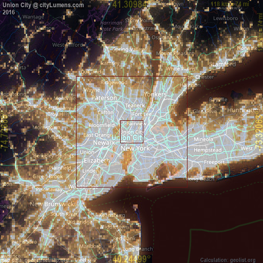
Analysis of Union City night lights 2016
Square area 10x10 km:
 72.89%
90-99
24.35%80-89
2.76%70-79
0%60-69
0%50-59
0%40-49
0%30-39
0%20-29
0%10-19
0%0-9
0%Square area 50x50 km:
47.29%90-99
21.2%80-89
7.19%70-79
8.29%60-69
6.25%50-59
2.71%40-49
1.94%30-39
1.88%20-29
2.21%10-19
1.02%0-9
0%Clear (daylight) street map image can be seen on geolist.org.
Map coordinates:
41° 18' 35.4" North, 74° 43' 36.8" West
40° 46' 46.4" North, 74° 1' 25.5" West
40° 14' 42" North, 73° 19' 14.3" West
Some cities around Union City sort by population:
• North Bergen
2.9 km =1.8 mi,  19°
19°
• Hoboken
4 km =2.5 mi,  190°
190°
• West New York
1.2 km =0.7 mi,  40°
40°
• Hell's Kitchen
3.2 km =2 mi,  120°
120°
• Secaucus
3 km =1.9 mi,  291°
291°
• Fairview
4.2 km =2.6 mi,  29°
29°
• Weehawken
1.1 km =0.7 mi,  165°
165°
• Guttenberg
2.2 km =1.4 mi,  50°
50°
5105634 (p: 69,156)
Sources (retrieved 2019-11-25):
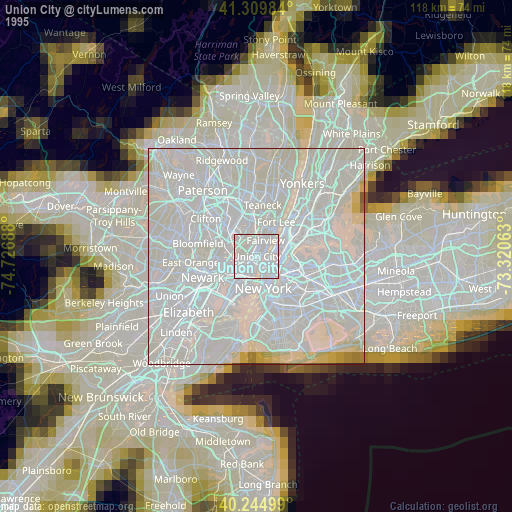
» NASA, Earths city lights 1995
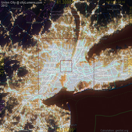
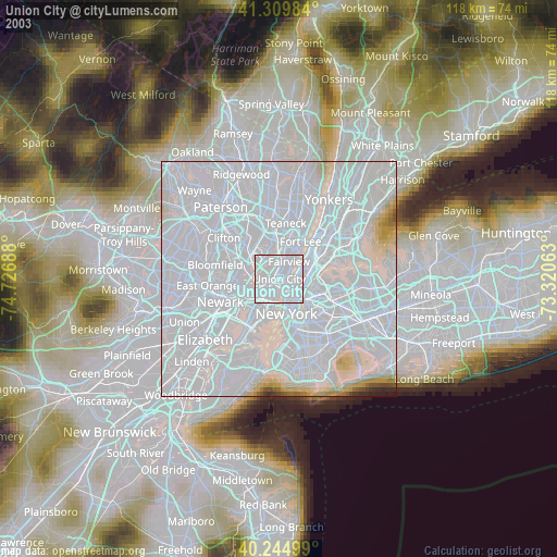
» NASA city lights 2003
» Earth at Night: Flat Maps 2012, 2016