Tiverton night lights from space
Night Light of Tiverton (Rhode Island) from space (United States) Src. Average luminocity for 10x10km area is 33.0763% and for 50x50km: 28.6862%.
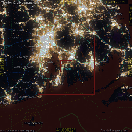
Analysis of Tiverton night lights 2016
Square area 10x10 km:
 0.32%
0.32%90-99
2.27%80-89
6.01%70-79
4.22%60-69
7.63%50-59
6.49%40-49
7.14%30-39
4.38%20-29
19.16%10-19
26.95%0-9
15.42%Square area 50x50 km:
5.92%90-99
5.25%80-89
3.31%70-79
3.14%60-69
3.67%50-59
3.76%40-49
3.72%30-39
3.86%20-29
7.8%10-19
15.97%0-9
43.61%Clear (daylight) street map image can be seen on geolist.org.
Map coordinates:
42° 8' 57.8" North, 71° 54' 59.4" West
41° 37' 33.4" North, 71° 12' 48.2" West
41° 5' 53.6" North, 70° 30' 36.9" West
Some cities around Tiverton sort by population:
• Fall River
9.7 km =6 mi,  29°
29°
• Bristol
7.2 km =4.5 mi,  322°
322°
• Portsmouth
4 km =2.5 mi,  229°
229°
• Middletown
11 km =6.8 mi,  216°
216°
• Swansea
13.7 km =8.5 mi,  8°
8°
• Head of Westport
12.6 km =7.8 mi,  92°
92°
• Newport East
13.7 km =8.5 mi,  206°
206°
• Warren
13 km =8.1 mi,  333°
333°
5225245 (p: 7,557)
Sources (retrieved 2019-11-25):
» Earth at Night: Flat Maps 2012, 2016