Sugarcreek night lights from space
Night Light of Sugarcreek (Pennsylvania) from space (United States) Src. Average luminocity for 10x10km area is 8.6769% and for 50x50km: 2.9245%.
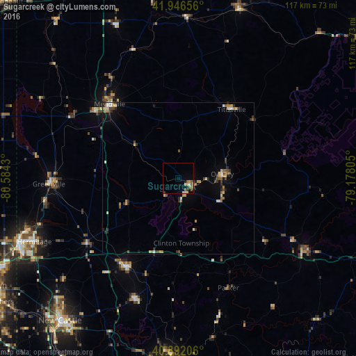
Analysis of Sugarcreek night lights 2016
Square area 10x10 km:
 0.51%
0.51%90-99
0.68%80-89
1.87%70-79
1.36%60-69
2.04%50-59
2.04%40-49
0.17%30-39
0.85%20-29
0.68%10-19
1.7%0-9
88.1%Square area 50x50 km:
0.18%90-99
0.36%80-89
0.44%70-79
0.43%60-69
0.37%50-59
0.42%40-49
0.56%30-39
0.4%20-29
0.58%10-19
0.82%0-9
95.43%Clear (daylight) street map image can be seen on geolist.org.
Map coordinates:
41° 56' 47.6" North, 80° 35' 3.5" West
41° 25' 17.2" North, 79° 52' 52.2" West
40° 53' 31.4" North, 79° 10' 41" West
Some cities around Sugarcreek sort by population:
• Hermitage
51.8 km =32.2 mi,  246°
246°
• Meadville
33.2 km =20.6 mi,  317°
317°
• Oil City
14.6 km =9.1 mi,  84°
84°
• Grove City
34.1 km =21.2 mi,  210°
210°
• Franklin
4.9 km =3 mi,  122°
122°
• Clarion
47.4 km =29.5 mi, 119°
• Greenville
42.6 km =26.5 mi,  267°
267°
• Titusville
28.6 km =17.8 mi,  37°
37°
5214696 (p: 5,120)
Sources (retrieved 2019-11-25):
» Earth at Night: Flat Maps 2012, 2016