Nixa night lights from space
Night Light of Nixa (Missouri) from space (United States) Src. Average luminocity for 10x10km area is 50.9881% and for 50x50km: 20.1902%.
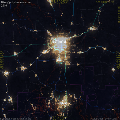
Analysis of Nixa night lights 2016
Square area 10x10 km:
 5.1%
5.1%90-99
5.78%80-89
7.31%70-79
10.03%60-69
8.16%50-59
13.44%40-49
13.78%30-39
7.31%20-29
14.29%10-19
13.44%0-9
1.36%Square area 50x50 km:
4.58%90-99
3.51%80-89
2.43%70-79
2.54%60-69
2.47%50-59
3.51%40-49
2.77%30-39
2.89%20-29
3.48%10-19
6.84%0-9
64.99%Clear (daylight) street map image can be seen on geolist.org.
Map coordinates:
37° 36' 9.1" North, 93° 59' 50.9" West
37° 2' 36.2" North, 93° 17' 39.7" West
36° 28' 48.4" North, 92° 35' 28.4" West
Some cities around Nixa sort by population:
• Springfield
19.1 km =11.9 mi,  358°
358°
• Ozark
8.2 km =5.1 mi,  107°
107°
• Republic
18.6 km =11.6 mi,  297°
297°
• Branson
45 km =28 mi,  171°
171°
• Aurora
38.5 km =23.9 mi,  257°
257°
• Marshfield
47.5 km =29.5 mi,  46°
46°
• Battlefield
10.5 km =6.5 mi,  320°
320°
• Willard
31.4 km =19.5 mi,  337°
337°
4400648 (p: 20,984)
Sources (retrieved 2019-11-25):
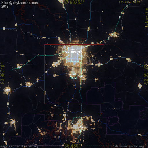
» Earth at Night: Flat Maps 2012, 2016