Aurora night lights from space
Night Light of Aurora (Missouri) from space (United States) Src. Average luminocity for 10x10km area is 15.586% and for 50x50km: 4.3708%.
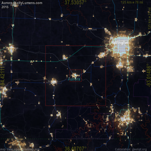
Analysis of Aurora night lights 2016
Square area 10x10 km:
 1.3%
1.3%90-99
1.3%80-89
2.6%70-79
0.65%60-69
3.41%50-59
4.38%40-49
1.79%30-39
2.11%20-29
1.14%10-19
3.41%0-9
77.92%Square area 50x50 km:
0.31%90-99
0.57%80-89
0.48%70-79
0.57%60-69
0.8%50-59
0.71%40-49
0.34%30-39
0.7%20-29
0.86%10-19
2.9%0-9
91.76%Clear (daylight) street map image can be seen on geolist.org.
Map coordinates:
37° 31' 50.1" North, 94° 25' 16" West
36° 58' 15.2" North, 93° 43' 4.7" West
36° 24' 25.5" North, 93° 0' 53.5" West
Some cities around Aurora sort by population:
• Springfield
46.1 km =28.6 mi,  53°
53°
• Nixa
38.5 km =23.9 mi,  77°
77°
• Ozark
45.8 km =28.5 mi, 83°
• Republic
26.8 km =16.7 mi, 51°
• Carthage
57.3 km =35.6 mi,  293°
293°
• Monett
19.2 km =11.9 mi,  255°
255°
• Battlefield
34.8 km =21.6 mi,  62°
62°
• Willard
45.2 km =28.1 mi,  34°
34°
4375349 (p: 7,477)
Sources (retrieved 2019-11-25):
» Earth at Night: Flat Maps 2012, 2016