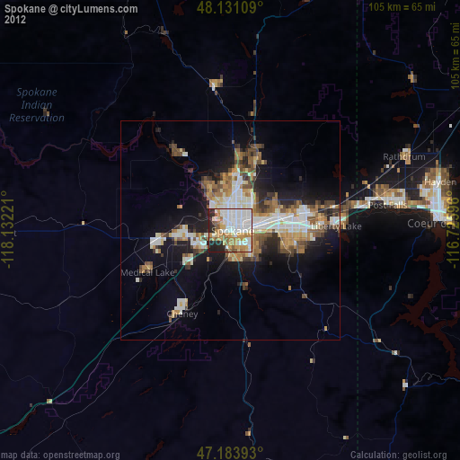
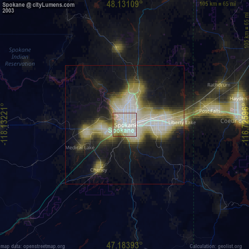
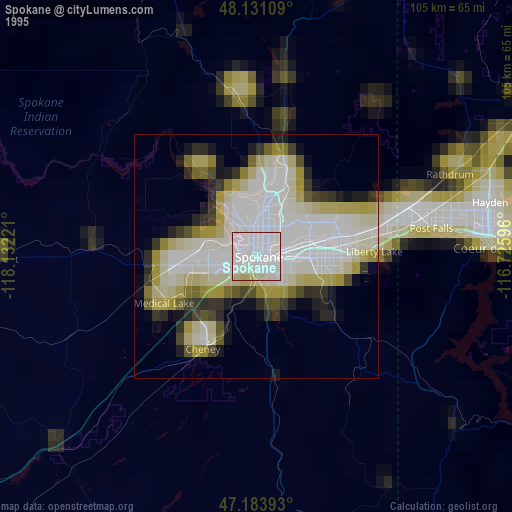
Spokane night lights from space
Night Light of Spokane (Washington) from space (United States) Src. Average luminocity for 10x10km area is 77.2827% and for 50x50km: 16.4783%.
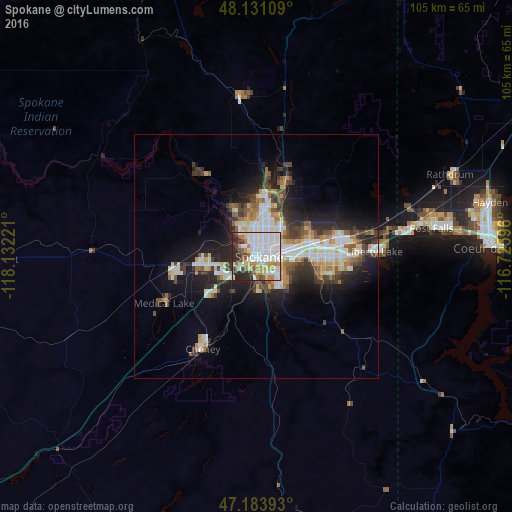
Analysis of Spokane night lights 2016
Square area 10x10 km:
 34.08%
90-99
19.2%80-89
5.65%70-79
8.48%60-69
5.95%50-59
5.51%40-49
3.13%30-39
6.55%20-29
11.46%10-19
0%0-9
0%Square area 50x50 km:
3.74%90-99
3.15%80-89
1.7%70-79
1.89%60-69
1.4%50-59
2.03%40-49
1.9%30-39
2.82%20-29
4.41%10-19
8.23%0-9
68.73%Clear (daylight) street map image can be seen on geolist.org.
Map coordinates:
48° 7' 51.9" North, 118° 7' 56" West
47° 39' 34.8" North, 117° 25' 44.7" West
47° 11' 2.1" North, 116° 43' 33.5" West
Some cities around Spokane sort by population:
• Opportunity
14.2 km =8.8 mi,  94°
94°
• Cheney
22.1 km =13.7 mi,  209°
209°
• Veradale
16.6 km =10.3 mi, 93°
• Dishman
11.5 km =7.1 mi, 89°
• Fairwood
11.9 km =7.4 mi,  4°
4°
• Mead
13.2 km =8.2 mi,  24°
24°
• Airway Heights
12.4 km =7.7 mi,  262°
262°
• Country Homes
10 km =6.2 mi,  10°
10°
5811696 (p: 213,272)
Sources (retrieved 2019-11-25):
» NASA, Earths city lights 1995
» NASA city lights 2003
» Earth at Night: Flat Maps 2012, 2016