Spanish Fort night lights from space
Night Light of Spanish Fort (Alabama) from space (United States) Src. Average luminocity for 10x10km area is 43.4528% and for 50x50km: 30.3277%.
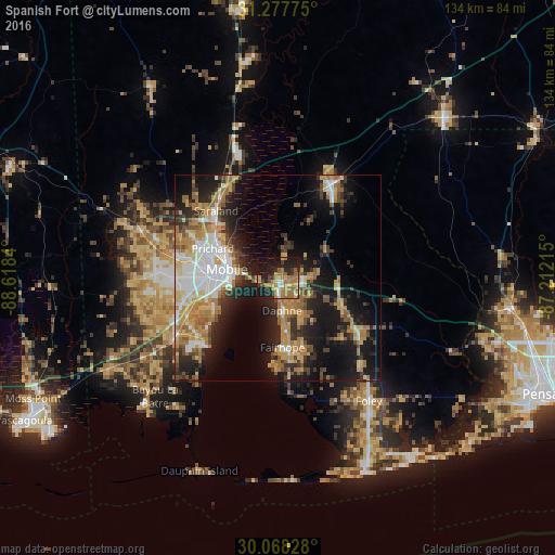
Analysis of Spanish Fort night lights 2016
Square area 10x10 km:
 2.27%
2.27%90-99
2.97%80-89
7.17%70-79
11.19%60-69
17.48%50-59
3.67%40-49
2.1%30-39
4.37%20-29
14.34%10-19
30.77%0-9
3.67%Square area 50x50 km:
4.98%90-99
3.93%80-89
4.27%70-79
5.62%60-69
6.28%50-59
2.73%40-49
3.37%30-39
4.28%20-29
7.19%10-19
18.5%0-9
38.85%Clear (daylight) street map image can be seen on geolist.org.
Map coordinates:
31° 16' 39.9" North, 88° 37' 6.2" West
30° 40' 29.7" North, 87° 54' 55" West
30° 4' 5.8" North, 87° 12' 43.7" West
Some cities around Spanish Fort sort by population:
• Mobile
12.4 km =7.7 mi,  280°
280°
• Daphne
8 km =5 mi,  171°
171°
• Prichard
17.2 km =10.7 mi,  294°
294°
• Fairhope
16.9 km =10.5 mi,  176°
176°
• Saraland
22 km =13.7 mi,  317°
317°
• Satsuma
24 km =14.9 mi,  325°
325°
• Chickasaw
18.2 km =11.3 mi,  302°
302°
• Robertsdale
23.7 km =14.7 mi,  124°
124°
4091136 (p: 8,065)
Sources (retrieved 2019-11-25):
» Earth at Night: Flat Maps 2012, 2016