Sinton night lights from space
Night Light of Sinton (Texas) from space (United States) Src. Average luminocity for 10x10km area is 21.428% and for 50x50km: 10.963%.
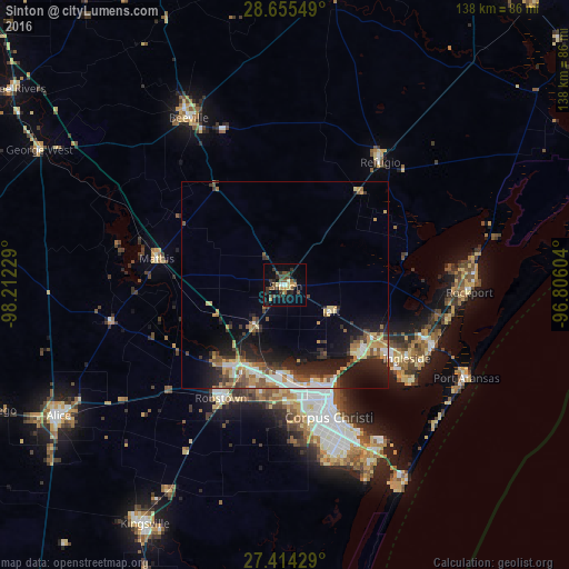
Analysis of Sinton night lights 2016
Square area 10x10 km:
 1.14%
1.14%90-99
1.14%80-89
2.84%70-79
3.22%60-69
1.52%50-59
5.11%40-49
5.68%30-39
5.87%20-29
5.87%10-19
10.98%0-9
56.63%Square area 50x50 km:
1.28%90-99
1.37%80-89
1.37%70-79
1.59%60-69
1.2%50-59
2.06%40-49
1.63%30-39
1.9%20-29
3.72%10-19
7.07%0-9
76.81%Clear (daylight) street map image can be seen on geolist.org.
Map coordinates:
28° 39' 19.8" North, 98° 12' 44.2" West
28° 2' 12" North, 97° 30' 33" West
27° 24' 51.4" North, 96° 48' 21.7" West
Some cities around Sinton sort by population:
• Corpus Christi
28.5 km =17.7 mi,  157°
157°
• Portland
25.4 km =15.8 mi,  134°
134°
• Beeville
46.9 km =29.1 mi,  329°
329°
• Robstown
31.6 km =19.6 mi,  209°
209°
• Rockport
44.5 km =27.7 mi,  92°
92°
• Ingleside
34.1 km =21.2 mi,  121°
121°
• Aransas Pass
38 km =23.6 mi,  111°
111°
• Mathis
31.9 km =19.8 mi,  281°
281°
4728826 (p: 5,736)
Sources (retrieved 2019-11-25):
» Earth at Night: Flat Maps 2012, 2016