Beeville night lights from space
Night Light of Beeville (Texas) from space (United States) Src. Average luminocity for 10x10km area is 35.8294% and for 50x50km: 2.2192%.
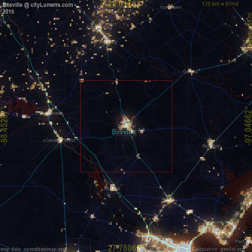
Analysis of Beeville night lights 2016
Square area 10x10 km:
 2.18%
2.18%90-99
4.17%80-89
5.95%70-79
7.14%60-69
6.35%50-59
6.75%40-49
5.75%30-39
4.56%20-29
6.35%10-19
34.33%0-9
16.47%Square area 50x50 km:
0.12%90-99
0.18%80-89
0.29%70-79
0.31%60-69
0.32%50-59
0.47%40-49
0.34%30-39
0.41%20-29
0.58%10-19
1.78%0-9
95.18%Clear (daylight) street map image can be seen on geolist.org.
Map coordinates:
29° 1' 3.5" North, 98° 27' 10.3" West
28° 24' 3.4" North, 97° 44' 59.1" West
27° 46' 50.4" North, 97° 2' 47.8" West
Some cities around Beeville sort by population:
• Corpus Christi
75.2 km =46.7 mi,  152°
152°
• Alice
78.7 km =48.9 mi,  203°
203°
• Portland
71.7 km =44.6 mi,  144°
144°
• Robstown
68.4 km =42.5 mi,  173°
173°
• Rockport
80 km =49.7 mi,  121°
121°
• Ingleside
78.5 km =48.8 mi, 137°
• Sinton
46.9 km =29.1 mi, 149°
• Mathis
34.9 km =21.7 mi,  192°
192°
4673258 (p: 13,277)
Sources (retrieved 2019-11-25):
» Earth at Night: Flat Maps 2012, 2016